Lutheran Cemetery (All Faiths Cemetery)

An 1882 pictorial illustrates the grounds of Lutheran Cemetery. (Munsell)

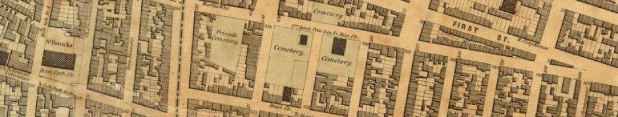
Lutheran Cemetery is one of over a dozen cemeteries developed along the Brooklyn-Queens border after the New York legislature passed the Rural Cemetery Act in 1847, spurring the creation of new large-scale cemeteries throughout the state. Founded in 1850 by the United Lutheran Churches of New York and incorporated in 1852, the cemetery was envisioned by Reverend F.W. Geissenhainer (1797-1879) when pastor of St. Paul’s Lutheran Church on Sixth Avenue and Fifteenth Street in Manhattan.

Through Dr. Geissenhainer’s efforts, and largely at his own personal cost, Lutheran Cemetery at Middle Village was established as an open, non-sectarian burial place where graves would be sold at affordable prices so that they could be available to people of limited means. By the 1880s, nearly 200,000 internments had been made in Lutheran Cemetery’s 225 acres and it was one of the busiest cemeteries in the vicinity of New York, averaging 12,000 interments each year. On Sundays, thousands of visitors took to the cemetery’s handsome, undulating grounds that included Trinity Lutheran Church, a chapel that was situated on a knoll in the south section of the cemetery.

This 1922 view of Lutheran Cemetery shows Trinity Lutheran Church, which stood near the entrance to the south section of the cemetery grounds. The church burned down in the 1970s; a community mausoleum stands on its site today. (NYPL)

Although Lutheran Cemetery has always welcomed people from all religious denominations, it was primarily patronized by the city’s German Protestant population during its early period. At the turn of the 20th century, it was the metropolis’ leading German burial ground and today the cemetery’s older tombstones bear this out in their strong Northern European character and German surnames. Epitaphs, often in the German language and written in Gothic script, speak of great loss, sorrow, and a desire for peace.

A view of monuments in Lutheran Cemetery’s north section, April 2023 (Mary French)

Lutheran Cemetery was not only the favored place for the city’s German Americans to be laid to rest, it was also a preferred spot to take their own lives. German immigrants were unusually suicidal during the 19th century—so much so that American economist and statistician Francis A. Walker called them “the great suiciding people among us.” Writing in 1875 about this phenomenon among German Americans, Walker noted that “one half of all the suicides which take place among the entire population are accredited to them.” Historical newspaper coverage reveals that over two dozen people committed suicide on the grounds of Lutheran Cemetery during the first 50 years of its history. Among them were Wilhelm Fuhlmer, a 26-year-old German tailor who in 1851 shot himself in the head on the grave of the wife of his grave and only child; Christopher Kunzman, who threw himself on a grave and slit his throat with a knife in 1872; and Frances Wittstadt, who poisoned herself on her husband’s grave in 1897.

A view of the Slocum Monument at Lutheran Cemetery, April 2023. (Chris Bendall)

Another tragic chapter in the history of the city’s German community is documented by the Slocum Monument situated in the south section of Lutheran Cemetery. The monument commemorates the 1,021 lives that were lost when the General Slocum steamboat caught fire and sank in the East River on June 15, 1904. Most of the passengers on board were members of St. Mark’s Lutheran Church, located in the area known as Little Germany on Manhattan’s Lower East Side.

The burning of the Slocum was New York City’s deadliest disaster until September 11, 2001, and the extensive loss of life led to the disintegration of the Lower East Side’s German community. Many of the Slocum victims were interred in private plots at Lutheran Cemetery and another 61 unidentified victims were interred in the common plot where the Slocum Monument stands. Though marking the burial place of the unidentified dead, the towering granite monument was intended to stand as an overall memorial of the disaster. It was unveiled on June 15, 1905, and an annual memorial service for the victims has been held at the monument every year since that date.

The Trump family gravesite at Lutheran Cemetery, April 2023 (Chris Bendall)

The Slocum Monument has long been the main historical attraction at Lutheran Cemetery, but recent events have raised interest in another spot here—the Trump family gravesite. Cemetery officials don’t disclose the location to the visitors, but forensic investigation will lead the determined explorer to the plot (hint: it’s near the cemetery’s southernmost boundary). Marked by a modest granite monument, it is the final resting place of former President Donald Trump’s paternal grandparents (Fred and Elizabeth), his parents (Fred and Mary), and his eldest brother, Fred Jr.

The historic Lutheran Cemetery now has over half a million interments and is known as “All Faiths Cemetery,” the result of a 1990 rebranding that was meant to better reflect the cemetery’s non-denominational status and the demographical and cultural shift in the communities it serves. The cemetery’s German clientele has disappeared as those families moved away and its newer graves and visitors reflect the eclectic mix of Latino, Slavic, and Asian families that have settled in the area in recent decades.

Chinese monuments marking newer graves stand in contrast to the older German plots at Lutheran Cemetery, April 2023 (Chris Bendall)
The location of Lutheran Cemetery in Middle Village, Queens. The cemetery’s 225 acres are separated into north and south sections on either side of  Metropolitan Avenue (OpenStreetMap)

View more photos of Lutheran / All Faiths Cemetery

Sources: The Cemeteries of New York (Judson 1881); History of Queens County (Munsell 1882); “With the Dead,” Brooklyn Times Union, Sep 14, 1888; The Leonard Manual of the Cemeteries of New York and Vicinity (1901); “Where Death Follows Death,” Newsday, Apr 20, 1988; “Occupations and Mortality of Our Foreign Population, 1870” Chicago Advance, Nov 12, Dec 10, 1874 and Jan 14, 1875. Reprinted in Discussions in Economics and Statistics (Walker 1899);  “Dreadful Suicide,” New York Spectator, Aug 28, 1851; “A Dramatic Suicide,” Brooklyn Daily Eagle, Feb 20 1872; “All Were Weary of Life,” Brooklyn Daily Eagle, Oct 19, 1897; “Many More Buried,” New York Times, Jun 21, 1904; “The Slocum Disaster. Monument for the Grave of the Unidentified Dead,” New York Tribune, Mar 5, 1905; “Infant Unveils Shaft,” New York Tribune, Jun 16, 1905; “A Spectacle of Horror—The Burning of the General Slocum,” Smithsonian Magazine, Feb 21, 2012; “Annual Memorial Service for Victims of General Slocum Tragedy,” Queens Gazette, Jun 27, 2018. “Tommy Hadziutko Marks 50 Years Working at All Faiths Cemetery in Queens,” Daily News, Dec 1, 2011; Queens Historical Society Walking Tour of Lutheran Cemetery, June 6, 2011; Our History – All Faiths Cemetery; All Faiths Cemetery Walk, November 6th 2020; OpenStreetMap

First Reformed Dutch Church of Brooklyn Cemetery

An 1834 map of Brooklyn depicts the First Reformed Dutch Church of Brooklyn Cemetery on Fulton Street between Smith and Hoyt Streets; the Church can be seen west of the cemetery, on Joralemon Street, where there congregation relocated in 1807

One of New York’s earliest Dutch burial grounds was located where the iconic Abraham & Straus building stands today in downtown Brooklyn. Situated on the south side of Fulton Street near Hoyt Street, the department store site was previously the graveyard of the First Reformed Dutch Church of Brooklyn, established by order of Governor Peter Stuyvesant in 1654. The half-acre cemetery was in use by 1656 and in 1666 the Reformed Dutch Church erected their first house of worship east of the burial ground, in the middle of the colonial highway that evolved into Fulton Street. In 1766, a new church was erected on the same site; this stood until 1807 when the congregation relocated to nearby Joralemon Street. In 1886 the congregation moved again, to the Park Slope location where they continue to worship today.

After the First Reformed Dutch Church of Brooklyn moved to Joralemon Street, they tore down the Fulton Street church but retained the old burial ground. They continued interments there until the 1840s when an ordinance prohibited further burials within Brooklyn city limits. In the winter of 1862-1863, politician and historian Henry Cruse Murphy twice visited the disused Dutch burial ground on Fulton Street and recorded the inscriptions he found on nearly 100 tombstones at the site. Dates of death on the gravemarkers ranged from the 1740s to the 1840s and names included those of some of Brooklyn’s original Dutch settlers, such as Boerum, Remsen, and Barkeloo.

Ancient tombstones mark graves transferred from the First Reformed Dutch Church Cemetery on Fulton Street to the Cedar Dell section at Greenwood (Mary French, May 2016)

In 1865, the First Reformed Church began making arrangements to remove their Fulton Street cemetery so that the property could be sold. They acquired a large plot of ground at Greenwood Cemetery and in 1866 received permission from the State Legislature to disinter the bodies and relocate them to Greenwood, a process that was completed in 1868. Developer Andrew S. Wheeler subsequently acquired the former burial ground on Fulton Street and in 1873 erected a five-story cast-iron-fronted luxury commercial building on the site. In the 1880s, retailers Wechsler & Abraham purchased the building, rebuilt the interior, and added an extension to create a lavish department store; the company became Abraham & Straus in 1893. Now Macy’s, this building has long been the heart of downtown Brooklyn’s Fulton Mall shopping corridor.

Though gone from its original location in downtown Brooklyn, the essence of the First Reformed Dutch Church of Brooklyn burial ground can be found in Greenwood Cemetery’s Cedar Dell section, where the circular layout of tombstones relocated from Fulton Street makes it one of the cemetery’s signature areas. The distinctive brownstone monuments are some of the oldest at Greenwood and were recently restored as part of a major renovation of the Cedar Dell section. One by one, the old tombstones were unearthed, cleaned, and reset, revealing inscriptions hidden for decades and uncovering reminders of Brooklyn’s forgotten past.

The Cedar Dell section at Greenwood Cemetery, May 2016 (Mary French)
Before and after photos of the gravestone of Sarah Bouton (d. 1823) show the transformation achieved by Greenwood Cemetery’s restoration team in repairing and resetting the First Reformed Dutch Church Cemetery monuments at Greenwood Cemetery (Neela Wickremesinghe @brooklyn_conservator)
The First Reformed Dutch Church Cemetery in 1855
Detail from an 1886 map (left) showing the Wechsler & Abraham department store (later Abraham & Straus) that was built on the First Reformed Dutch Church Cemetery site; a 2022 Google Earth view shows the original store and its expansions, still at at the site today.

Sources: Martin’s 1834 Map of Brooklyn, Kings County, Long Island; Perris’ 1855 Maps of the City of Brooklyn, Pl 28; Robinson’s 1886 Atlas of the city of Brooklyn Pl 2; History of the First Reformed Protestant Dutch Church of Breuckelen, now known as The First Reformed Church of Brooklyn, 1654 to 1896; The Ferry Road on Long Island (Armbruster 1919); “Memoranda Taken from the Tombstones in the Old Dutch Burying Ground in Fulton St…” Long Island Historical Society Quarterly July 1939; “Our Albany Correpondence,” Brooklyn Daily Eagle, Mar 28, 1866; “An Old Landmark Gone,” Brooklyn Union, May 14, 1868; “Old Dutch Burying Ground,” Brooklyn Daily Eagle, Nov 29, 1872;  “The Dead…Brooklyn Graves That Have Been Opened,” Brooklyn Daily Eagle, Oct 2 1875; “The Old Dutch Grave Yard,” Brooklyn Daily Eagle, Mar 28, 1881; “Old Burial Ground,” Brooklyn Daily Eagle,” Aug 28, 1886;  “Restoring Brooklyn’s Queen of Department Stores,” New York Times, Nov 22, 2019;  Ooooh, look at that curve!, The Green-Wood Cemetery, Facebook, Sep 2, 2022; [Sarah Bouton tombstone], @brooklyn_conservator, Instagram, Oct 25, 2022

Melrose Cemetery

Melrose Catholic Cemetery in 1867

Melrose Cemetery was a 19th-century German Catholic burial ground that was situated on land that is now within the courtyard of the Bronxchester public housing development in the Melrose section of the South Bronx. In November of 1853, Rev. John Hughes, Archbishop of the Archdiocese of New York, purchased a parcel of land on the north side of Carr Street, which was just south of present-day East 156th Street between St. Ann’s Avenue and Hegney Place.  Archbishop Hughes acquired the 200 ft x 150 ft  property to serve the burial needs of the new German Catholic Church of the Immaculate Conception, which opened on East 150th Street at Melrose Avenue in May of 1853.

While Melrose Cemetery was primarily a burial ground for the local Immaculate Conception parish, records show a number of German Catholic residents of Manhattan were also laid to rest here during the 25 years the cemetery was in operation. The Archdiocese required Manhattan’s parishes to bury their dead at Calvary Cemetery in Queens during this time; however, many German Catholics preferred interment among their Teutonic brothers and sisters rather than at the Irish-dominated Calvary. Archbishop Hughes quashed several attempts by the city’s German Catholic parishes to establish their own burial grounds in Manhattan; it appears Melrose Cemetery served as an Archdiocese-sanctioned alternative burial place for the city’s German Catholics until the cemetery closed in the 1870s.

Obituary of Catharina Ehatt, a member of the German Catholic parish of St. Joseph’s in Harlem, who was interred in Melrose Cemetery in 1870

After Melrose Cemetery closed to burials in the 1870s, the property was abandoned and neglected. Friends and relatives transferred the remains of most of those buried here to other cemeteries, but many graves of the unclaimed were still present and in a sad state of misuse when an Evening Post reporter visited the site in 1899. Referring to the cemetery as “St. Mary’s,” the newspaper reports that the German Catholic graveyard at Melrose had become a “pasturage for eight or ten cows, and a barnyard in which a hundred or more hens take their recreation, and dismantled wagons and trucks are heaped up in the corners.” Graves surrounded by little iron fences were still visible, as were several headstones, including those of Michael Bundscheih (d.1871), Katherina Weiners (d.1861), and Joseph Bramen (d.1865).

The cemetery continued in its abandoned state until the property was condemned by the city as part of the Bronxchester Urban Renewal Project in 1974. It is not known if any remaining graves were transferred from the site before the property was redeveloped into a courtyard and recreational area for the Bronxchester Houses.

This detail from a 1904 map depicts the location of Melrose Cemetery on the north side of Carr St, south of E 156th St between German Pl (today’s Hegney Pl) and St. Ann’s Ave
A 2018 aerial view shows the Bronxchester public housing development; arrow indicates approximate location of the former location of Melrose Cemetery (NYCThen&Now)

Sources: Beer’s 1867 Plans of Westchester, West Farms, Morrisania, Westchester Co. and Part of New York County; Bromley’s 1904 Atlas and owner’s names, borough of the Bronx Pl 7; Westchester County Conveyances, Vol 256 p219-221, “United States, New York Land Records, 1630-1975,” FamilySearch; Bodies in Transit Registers IX & X, Municipal Archives, City of New York; “Died,” New York Herald, Aug 4 1867; “Died,” New York Herald , Nov 27 1870; “Neglected Graves in Melrose,” Evening Post, Dec 2 1899; “The Catholic Cemeteries of New York,Historical Records and Studies 1 (1900); “Detailed List of Exempt Properties of the City of New York, 1919” The City Record, May 23 1919 Supplement; Cemeteries of the Bronx (Raftery 2016)

Attorney Street Methodist Protestant Church Burial Vaults

Newspaper headline, Apr 4, 1880

Early on an April morning in 1880, inhabitants of the crowded tenement buildings near the corner of Attorney and Delancey streets on Manhattan’s Lower East Side were startled by a crashing sound and  trembling of the ground that was first thought to be an earthquake. Upon the commotion, a Mr. Baker, who lived in an apartment next to the Wesley Methodist Chapel on Attorney Street, looked out of his window and saw what used to be a churchyard behind the chapel had become a hole in the ground. The church sexton came running from his home across the street, declaring that he knew as soon as he heard the great noise that the old burial vaults in the churchyard had fallen in.

This snippet from an 1852 map shows the Attorney Street Methodist Protestant Church and the rear yard where the burial vaults were located

The church was built in 1831 by the society of the First Methodist Protestant Church, one of the earliest Methodist Protestant congregations in the country. Behind their brick church building, which faced Attorney Street, was a small square yard where they constructed two underground burial vaults for the reception of bodies; these were reportedly quickly filled during the local cholera epidemics of the 1830s and 1840s. The Attorney Street Methodist Protestant Church acquired land in Brooklyn for future burials—first in Williamsburg and later in Bushwick—and the burial vaults behind their church probably ceased to be used in the 1850s. In 1873, the Attorney Street congregation itself relocated to Brooklyn, becoming the Fourth Street Methodist Protestant congregation in Williamsburg. They sold their property on Attorney Street to the Methodist Church Extension Society, which reopened it as a mission chapel.

Very few people in the neighborhood knew that there were vaults behind the church at the time they collapsed in 1880. A former sexton, speaking to newspaper reporters, claimed nearly 5,000 bodies were interred in the vaults. When the roof collapsed, the vaults became a jagged pit 12 feet deep, 25 long, and 15 feet wide. At the sides of the fallen plot of earth, beneath the arched side walls, scores of coffins could be seen, of every shape and size, broken and in disorder. Parts of skeletons were also visible among the debris.

Rather than exhuming the remains from the vaults and relocating them to another cemetery, the church trustees hired workmen to repair the roof by building two brick walls to support the arch. Remains exposed during the collapse were covered with earth excavated for the foundations of these walls.

The synagogue at 87 Attorney Street, originally the Attorney Street Methodist Protestant Church, just before it was demolished in 1989 (VillagePreservation)

In the late 1890s, the old Methodist church building on Attorney Street became home to a Jewish congregation and continued to be used as a synagogue until the building was demolished in 1989. In 2000, an apartment building was built on the church site but the rear yard was left as open space.

Like their 1880s counterparts, it’s likely no one in the neighborhood today is aware that burial vaults—and the remains of several thousand 19th-century Lower East Siders—may still be present under the small rear yard at 87 Attorney Street.

An 1879 map shows the Attorney Street Methodist Church property and surrounding neighborhood about the time the burial vaults collapsed
A 2022 aerial view shows the apartment building on the site of the Attorney Street Methodist Protestant Church, and the rear yard where the underground burial vaults may still be present (GoogleEarth)

Sources: Dripps’ 1852 Map of the City of New-York extending northward to Fiftieth St; Bromley’s 1879 Atlas of the Entire City of New York, Pl 6; New York County Conveyances, Vol 265, p615-617, Vol 282 p534-536, “United States, New York Land Records, 1630-1975,” FamilySearch; Cyclopaedia of Methodism (Simpson 1880); Annals of New York Methodism (Seaman 1892); From Abyssianian to Zion: A Guide to Manhattan’s Houses of Worship (Dunlap 2004); “The Corner Stone of the Associated Methodist Church…” Commercial Advertiser, Oct 27 1830; “Notice,” New York Evangelist, Apr 2 1831; Doggett’s New-York City Directory for 1845 & 1846; “Burial Vaults Caving In,” The Sun, Apr 4 1880; “An Old Burial Vault Opened,” New York Tribune, Apr 4 1880; “An Old Burial-Vault Caves In,” New York Times, Apr 4, 1880; “City and Suburban News,” New York Times, Apr 6 1880; “Undermining the Church,” The Sun, Apr 14 1880; “A Synagogue’s Wall Collapses,” New York Times, Jan 29, 1989; Synagogue, 87 Attorney Street (Village Preservation)

Ocean View Cemetery

Gatehouse and entrance at Ocean View Cemetery, April 2017 (Mary French)

In the winter of 1899-1900, two new cemetery organizations—Ocean View and St. Agnes—began acquiring tracts of land near Staten Island’s south shore. By 1901 the two corporations owned several hundred acres stretching between Amboy Road and Arthur Kill Road in what is now the Oakwood/Richmond sections of Staten Island. The Ocean View Cemetery corporation, which absorbed the St. Agnes Cemetery corporation in 1905, established a namesake cemetery on part of the land they had amassed and sold off the remainder of the property to other cemetery corporations. Today this cemetery greenbelt includes United Hebrew Cemetery, Mount Richmond Cemetery, Frederick Douglass Memorial Park, and Ocean View Cemetery.

Ocean View Cemetery is located on Amboy Road in the Oakwood section of Staten Island. At 105 acres, it is one of the island’s largest cemeteries. Officially known as Ocean View—the Cemetery Beautiful, Inc., it is a nondenominational burial ground where over 50,000 people of diverse religions and nationalities are laid to rest.

From 1925 until 1940, part of Ocean View’s property was separately incorporated as Valhalla Burial Park, which was marketed to the local Scandinavian community. After the Valhalla Burial Park corporation declared bankruptcy in 1940, its grounds were reabsorbed into Ocean View Cemetery. Evidence of the former Valhalla Burial Park can be found on Ocean View’s north side, where there are large concentrations of grave markers bearing Norwegian, Swedish, and Danish surnames. Other notable burial grounds at Ocean View Cemetery include the Veterans section, marked by a flagpole and World War I monument, where a Veterans Day commemoration ceremony has been held every year since 1919, and the government-owned Merchant Marine Cemetery situated at a back corner of Ocean View.

A 1921 advertisement for the Ocean View Mausoleum

The intrepid explorer will find the ruins of Ocean View Mausoleum on a hill just south of the cemetery’s Amboy Road entrance. Designed by Clinton and Russell, one of New York’s leading architectural firms at the turn of the century, Ocean View Mausoleum was touted as the city’s first community mausoleum when it opened in 1920. Promotional materials describe it as a “scientific triumph and an artistic masterpiece,” “constructed of the finest grades of massive granite, stone, marble, and bronze,” “imposing in its air of grandeur and richness,” and “as permanent as the Pyramids of Egypt.” Today this once-celebrated structure is hidden from public view behind a stand of trees and visitor access to any loved ones interred within its crypts is blocked by a chainlink fence.

Fortunately, Ocean View Cemetery’s other architectural gem has withstood the passage of time and still stands majestically at the Amboy Road entrance. Part of landscape architect Daniel W. Langton’s original design for Ocean View’s grounds, the towered neo-Gothic stone gatehouse and imposing ironwork gates were completed in 1905.

This vintage postcard is in the Seymour B. Durst Old York Library collection at Columbia University. Postmarked 1911, it shows Ocean View’s entrance and gatehouse as they appeared in the cemetery’s early days.
The derelict Ocean View Mausoleum, March 2023 (Mary French)
Location of Ocean View Cemetery in Oakwood, Staten Island (OpenStreetMap)

View more photos of Ocean View Cemetery

Sources: The Leonard Manual of the Cemeteries of New York and Vicinity (1901); Fairchild Cemetery Manual (1910); Realms of History: The Cemeteries of Staten Island (Salmon 2006); One Thousand New York Buildings (Brockman & Harris 2002); AIA Guide to New York City (White et al 2010); “Communications from Departments and Corporation Officers,” The City Record, Nov 16, 1899; “Wrought Metal Work in America,” House and Garden, July 1905; “Business Troubles,” The Sun, Jun 16, 1906; Reports of Decisions of the Public Service Commission First District of the State of New York, Vol. IV Jan 1 1913 to Dec 31 1913 (Public Service Commission 1914); “Fights Attempt to Extend Cemetery,” New York Herald, Jul 12, 1919; “Open for Inspection,” Staten Island Advance, Sep 11, 1920; “Ocean View Mausoleum,” New York Herald, May 29, 1921; “Cemetery Seeks Reorganization,” Brooklyn Daily Eagle, Feb 3, 1940; “Frederick A. Bunn,” Otsego Farmer, May 1 1942; “‘Freedom Isn’t Free’: Veterans honored at Ocean View Cemetery Ceremony,” Staten Island Advance, Nov 11, 2022; Ocean View—The Cemetery Beautiful, Inc.

© Mary French 2010-2024