Wallabout Cemetery

Wallabout Cemetery is depicted on this 1834 map of Brooklyn

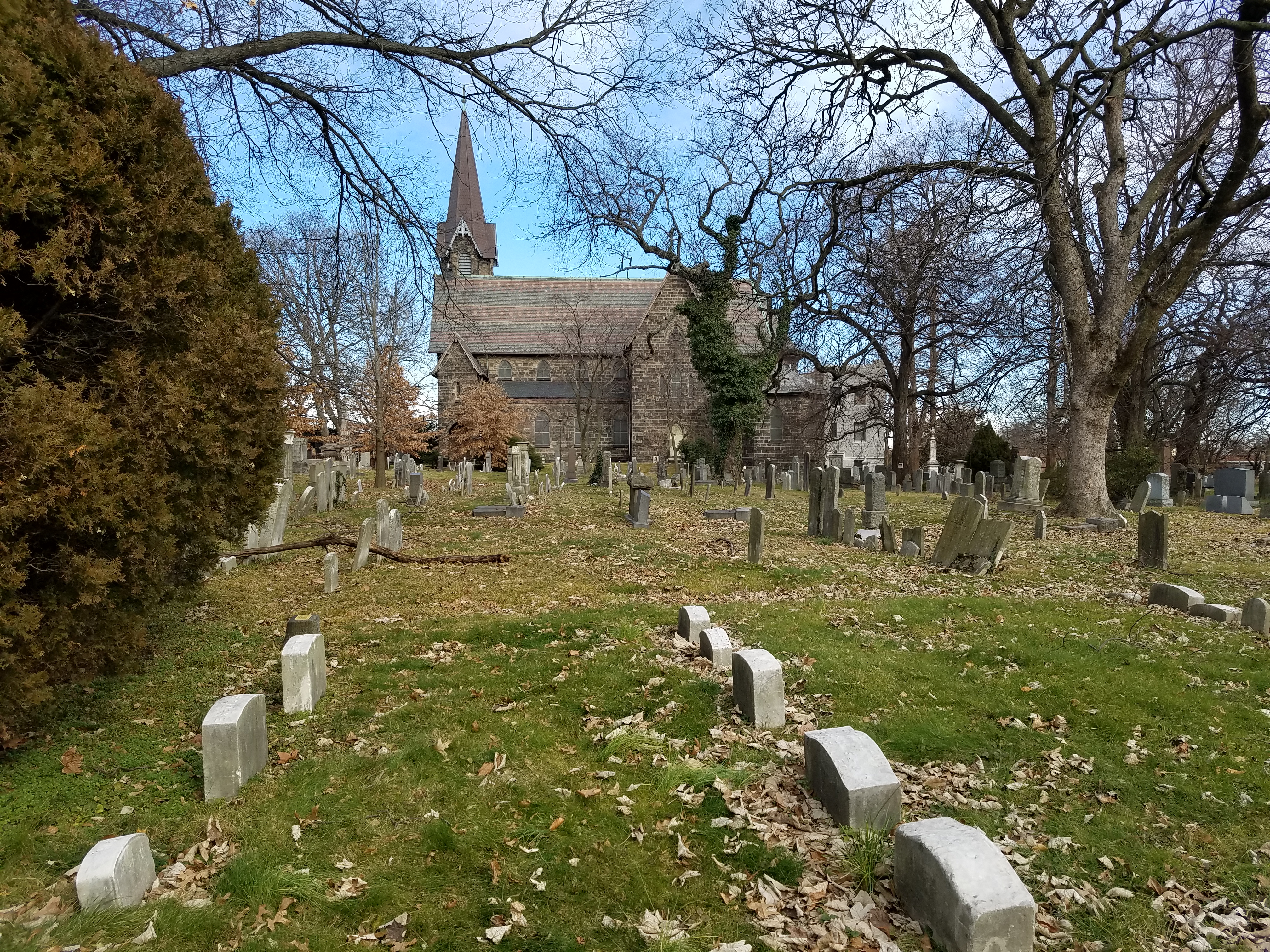
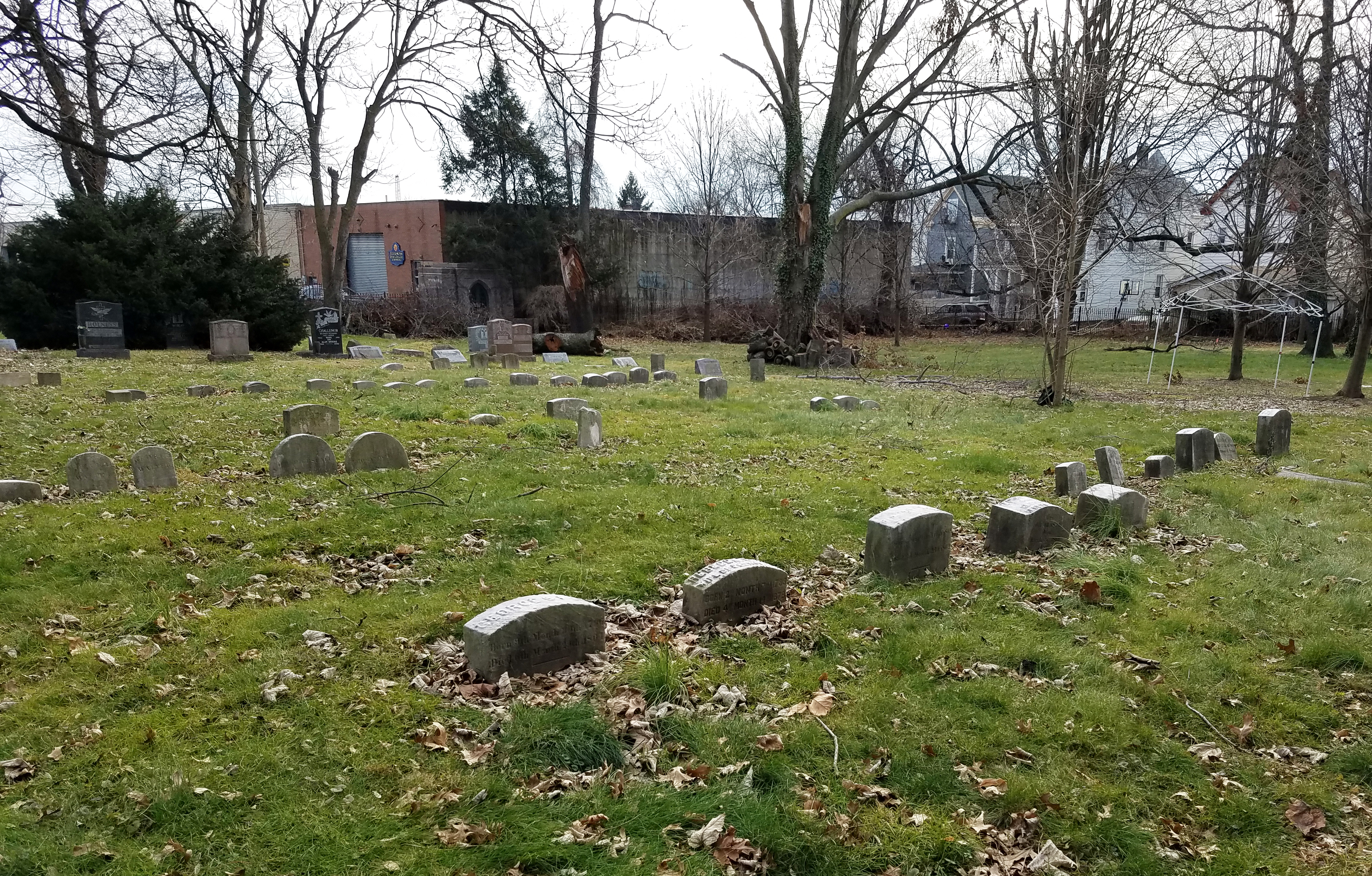
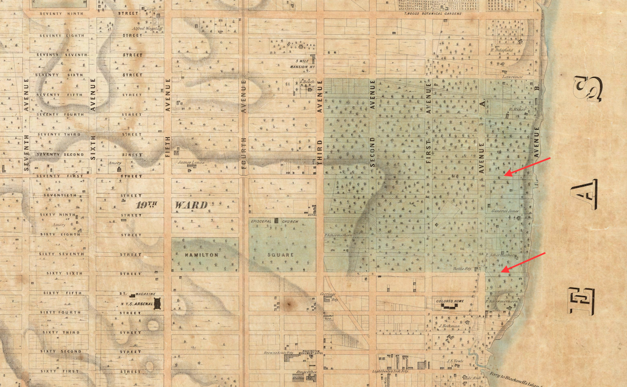
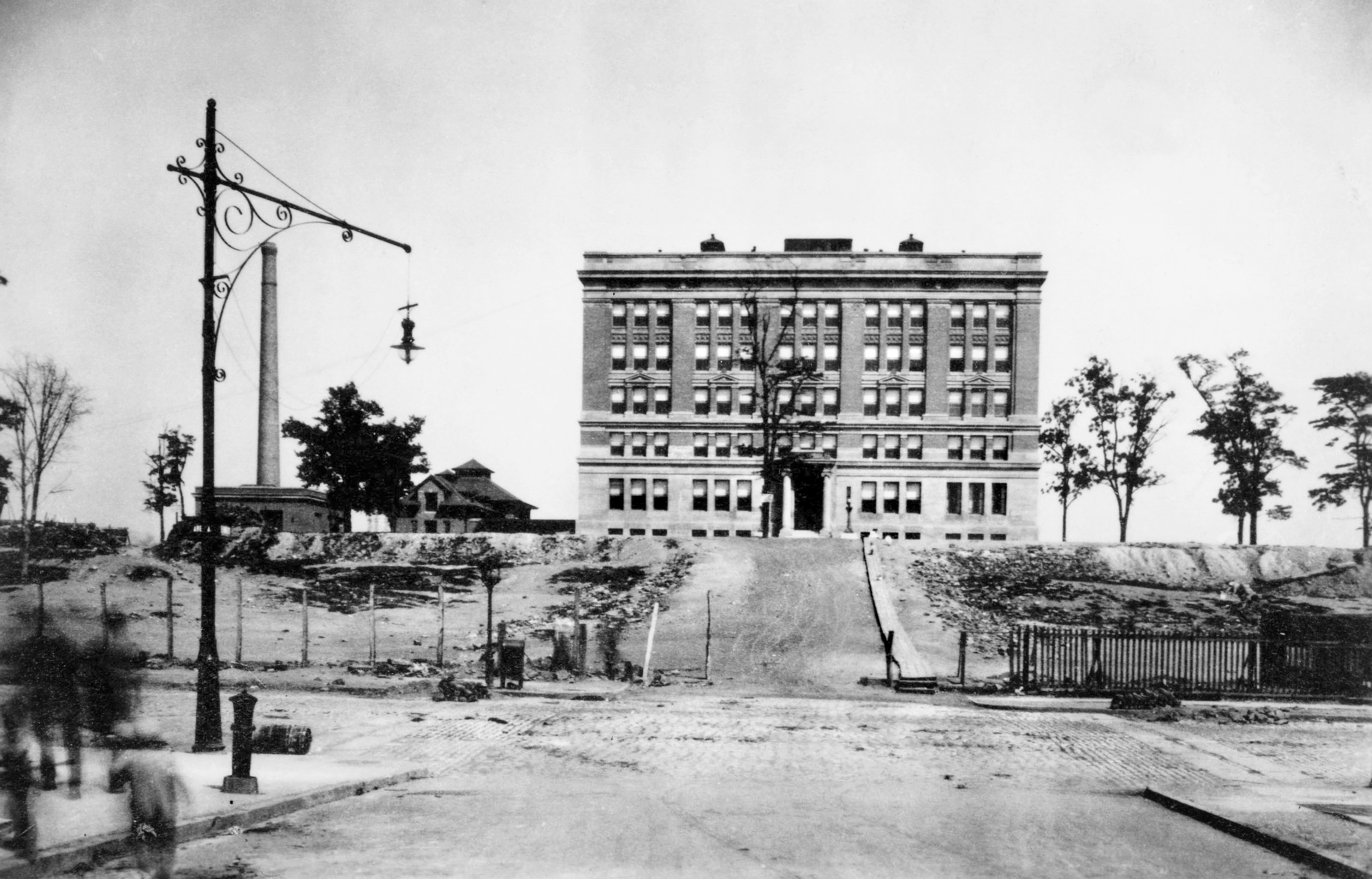
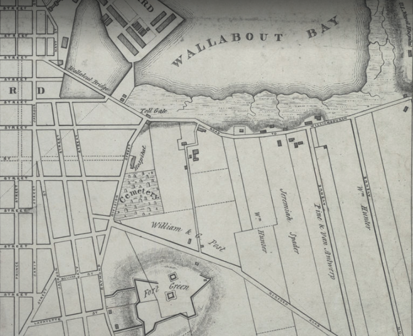
Just north of Fort Greene Park in Brooklyn is a site in the middle of the superblocks formed by the vast Whitman-Ingersoll public housing developments. Situated between St. Edwards Street, North Portland Avenue, Auburn Place, and Park Avenue, this site contains the Walt Whitman Branch of the Brooklyn Public Library, P.S. 67/Charles A. Dorsey School, and the former Cumberland Hospital—the birthplace of sports greats Michael Jordan and Mike Tyson, now a homeless shelter and medical clinic. In the century before these institutions were erected here, this land was the Wallabout Cemetery, a public burial ground for the citizens of the City of Brooklyn.

In the 1820s, the rapidly growing town (later city) of Brooklyn was running out of places to bury its dead. “Where shall I deposit the remains of my friend,” was a frequent question among the town’s citizens, according to the author of a letter published in the Long Island Star. The letter writer further commented that a survey of the “scanty burying grounds among us” was convincing evidence of the need for a public cemetery to be used by all denominations. In 1824 the town appointed a committee to find a suitable property for this purpose, eventually choosing five acres of farmland within a mile of the village, near Fort Greene and Wallabout Bay.

A diagram of the Wallabout Cemetery allotments from an 1835 newspaper article

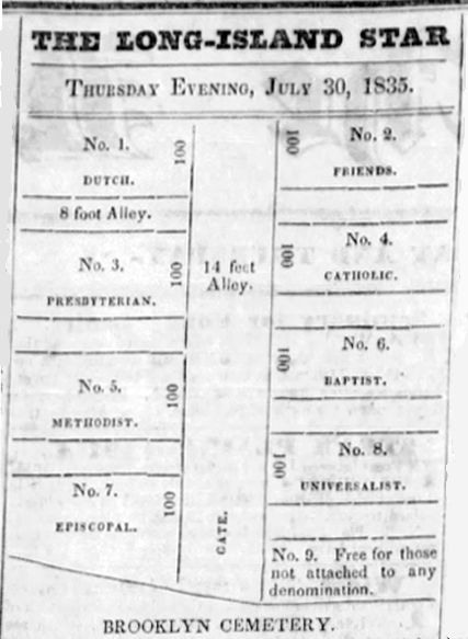
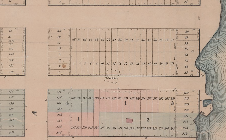
At a town meeting in April of 1827, the burial ground committee announced that preparation of the public cemetery was almost completed and that some graves had already been made in the allotments assigned to eight denominations—Reformed Dutch, Presbyterian, Methodist, Episcopal, Friends, Catholic, Baptist, and Universalist—and a ninth, common lot for use by the town for burial of the poor and those unaffiliated with a church. “The different allotments are separated and ornamented with forest trees,” the committee reported, “the fences and gateway are of solid masonry and the passage and road in front of the passage is paved.” Their report on the cemetery further boasts that “no place in the town is now more eligibly situated and better prepared for the purposes of interment, and that it probably contains space enough for each of our citizens who are journeying to this grave yard for a century to come; and that the work will remain a lasting monument of credit to this town.”

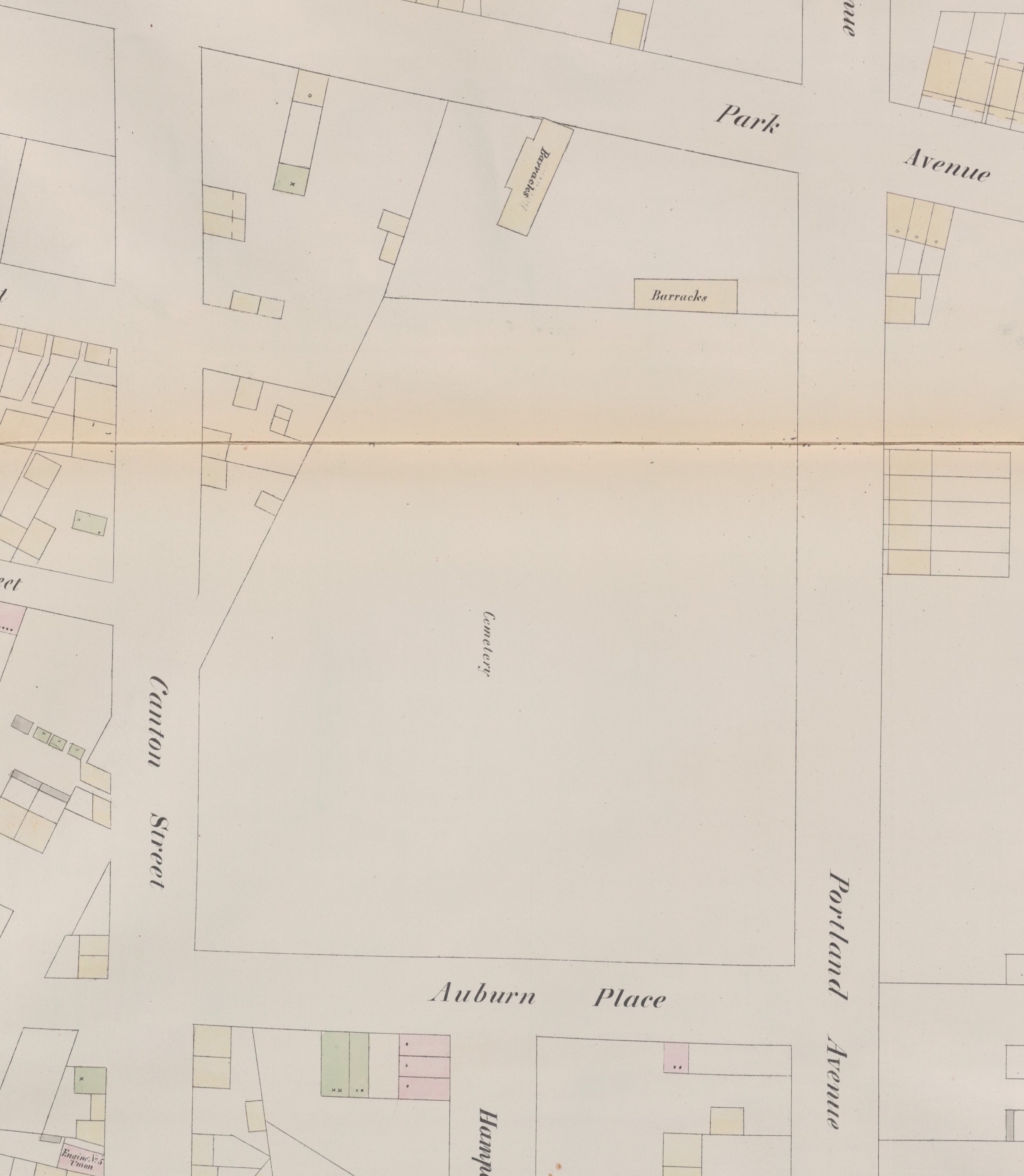
Despite these lofty aspirations, a mere 10 years later the Long Island Star lamented that Wallabout Cemetery “is shamefully neglected by its keepers, if such it have, and the cattle, horses and hogs have been allowed to break over its enclosure.” Upkeep of the public cemetery was an ongoing problem, evidenced by regular newspaper reports of its poor condition. In 1849, burials were disturbed when Canton Street (now St. Edwards Street) was constructed along the cemetery’s west side; a year later, the city’s Board of Health reported that Wallabout Cemetery was “densely crowded with bodies” and recommended its closure.

A notice of the Wallabout Cemetery’s closure by the Brooklyn Board of Health in 1854

The City of Brooklyn finally closed the cemetery in 1854. In 1857 the state legislature  passed a bill authorizing  sale of the land and providing for burial plots for each denomination in the new, large cemeteries that opened in Brooklyn and Queens in the mid-19th century. Churches were responsible for removing the remains from their allotments, a process that took several years. In January 1861, Brooklyn Mayor Samuel S. Powell reported that the last of the remains had been removed from the Wallabout Cemetery and deposited in a plot acquired by the city at Evergreens Cemetery in Brooklyn.

As with many 19th-century cemetery removals, some graves in the Wallabout Cemetery were missed during the process and encountered during later construction. In 1867 laborers digging for a cellar on the former cemetery site exhumed a coffin containing human remains; the inscription on the coffin plate was John Switzer, who died in June 1846. Many years later, in March 1924, workers for the Brooklyn Edison Company found human bones when excavating for a conduit at St. Edwards Street along what had been the western boundary of the former cemetery. The bones were reportedly “of both sexes, one wrist bone decorated with a bracelet or arm band of crude iron.” Remains of other 19th-century Brooklynites that may have been overlooked during the removal of Wallabout Cemetery possibly rest today beneath the grounds of the public institutions built on the site in the early 20th century.

Wallabout Cemetery in 1855
A 2018 aerial view of the former Wallabout Cemetery site

Sources: Martin’s 1834 Map of Brooklyn, Kings County, Long Island ; Perris’ 1855 Maps of the City of Brooklyn, Pl 20; Laws of the State of New York, Passed at the 81st Session of the Legislature, Begun January 5th and Ended April 19th, 1858, Chap. 232; “Report,” Long Island Star, Jun 16, 1824; [Letter to Editor—Public Cemetery], Long Island Star, Jan 5, 1825; “Town Meeting,” Long Island Star, Apr 5, 1827; “Brooklyn Cemetery,” Long Island Star, Jul, 30, 1835; “The Violated Grave,” Long Island Star, Jan 11, 1838; “Common Council,” Long Island Star, Dec 30, 1839; “Common Council,” Brooklyn Evening Star, Nov 24, 1841; “The Burial Ground, Once More,” Brooklyn Daily Eagle, Jan 28, 1844; “Burial Grounds,” Brooklyn Evening Star, Oct 24, 1846; “Cemetery at the Wallabout,” Brooklyn Evening Star, Nov 9, 1849; “The Mayor’s Communication of the Wallabout Cemetery,” Brooklyn Evening Star, Nov 16, 1849; “Common Council,” Brooklyn Evening Star, Jan 22, 1850; “Removal of Dead Bodies,” Brooklyn Evening Star, May 22, 1850; “Public Notice,” Brooklyn Evening Star, Jul 24, 1854; “Things at Albany,” Brooklyn Daily Eagle, Mar 20, 1856; “New York Legislature,” Brooklyn Evening Star, Jan 26, 1857; “Notice to Episcopalians,” Brooklyn Daily Eagle, Aug 10, 1857; “Office of the Commissioners for Sale of the Burial Ground at the Wallabout,” Brooklyn Evening Star, Dec 15, 1857; “Wallabout Burying Ground,” Brooklyn Daily Eagle, Apr 27, 1858;  “Great Sale of 11th Ward Property,” Brooklyn Evening Star, Jun 8, 1858; “Burial of the Dead,” Brooklyn Daily Eagle, Feb 17, 1860; “Common Council Proceedings,” Brooklyn Evening Star, Jan 29, 1861; “Human Remains Found,” Commercial Advertiser, Oct 14, 1867; “Thinks Old Skeletons Are From Ancient Cemetery,” Brooklyn Daily Eagle, Mar 25, 1924; NYC Then&Now

St. Peter’s Church Cemetery & Friends Cemetery, Westchester Square

St. Peter’s Church Cemetery in January 2021; the markers in the foreground are part of the Friends Cemetery (Mary French)

The vibrant East Bronx neighborhood known as Westchester Square is one of the borough’s oldest settlements, founded in 1654 by a group of English colonists. Called Oostdorp (east village) by the Dutch, it was renamed West Chester after it transferred to the British in 1664. When the county of Westchester was formed in 1683, Westchester Village became the county seat and grew into a center of activity at the head of Westchester Creek.

At the outset of the village’s founding, a large tract of land was set aside at the heart of the settlement for common use by the community. It was on a portion of this common land, or village green, that the settlers established a community burial ground. The first Episcopal church structure was erected on the village green in 1700, on the same site as the present St. Peter’s Episcopal Church. The Society of Friends built a meetinghouse in 1723 immediately south of St. Peter’s Church. Both the Friends meetinghouse and the Episcopal church were situated adjacent to the community burying ground.

An 1868 map of the Town of Westchester shows St. Peter’s Church and the Friends meetinghouse, and their adjoining cemeteries, situated on Westchester Ave

That section of the historical village green that included the community burial ground, the Episcopalian church, and the Friends meeting house—an area now situated on the east side of Westchester Avenue between Seabury Avenue, Herschell Street, and Butler Place—is owned today by St. Peter’s Church. The cemetery adjoining the church includes the community burial ground that originated with the founding of Westchester Village, as well as plots used by St. Peter’s Church and the Friends meeting house. As such, it is the burial place of some of the earliest European settlers of the Bronx and is the borough’s oldest active cemetery.

St. Peter’s Church Cemetery

A 1927 view of St. Peter’s Church and Cemetery (NYPL)

In 1795 the trustees of the town of Westchester released to the Church of St. Peter’s the parcel of ground on which the church was erected “and also the Burying Ground adjoining the said church, as it is now enclosed and fenced, and which has heretofore been used for a Burial Place by the inhabitants of the Township, containing about one acre.” This burial ground had been used by the community since the founding of the village in the 17th century. Though belonging to the town, the burial ground overlapped with St. Peter’s churchyard and had been utilized by the church throughout the 18th century for its deceased members. The 1795 release of the property contained a stipulation that the Town of Westchester would be permitted to continue to bury its inhabitants, without any fee, in vacant parts of the burial ground, so that the community would “always be permitted to bury their dead near to and adjoining their families who have heretofore been buried in the said Burial Ground.”

James Minor Lincoln’s 1909 sketch of the St. Peter’s and Friends properties

In 1909, James Minor Lincoln collected inscriptions from 1,024 monuments in St. Peter’s Church Cemetery, the earliest dating to 1702. In his manuscript, Lincoln noted: “It is estimated that this cemetery has been filled two or three times, no grave can be dug anywhere without turning up bones and old gravestones that have been buried.” St. Peter’s interred 30-40 bodies a year in their overcrowded cemetery in the early 1900s; to expand the burial ground, in 1925 the church acquired the adjoining lot where the Friends meetinghouse had stood. Some of this property, which included a Friends burial ground (see below), was incorporated into St. Peter’s Church Cemetery and subsequently used for new burials. Interments are still made in St. Peter’s Church Cemetery, though they’ve been infrequent since the mid-20th century.

St. Peter’s Church and Cemetery complex was designated a city landmark in 1976 and was added to the National Register of Historic places in 1983. The cemetery wraps around the Gothic Revival church building (erected in 1855) with the largest section of the burial ground extending on the building’s south side. A smaller, 19th-century Gothic-style building, formerly used as a mortuary chapel and Sunday school, is located in the southwest corner of the cemetery. Tree-lined paths wind through an assortment of ancient and modern tombstones, family plots, vaults, and mausoleums memorializing three centuries of Westchester Square’s inhabitants.

Friends Cemetery

A view of the Friends Cemetery in August 1908; the fence separating the property from St. Peter’s Church Cemetery can be seen on the left side of the image (WCHS)

The Society of Friends, a dominant presence in the early years of Westchester Village, had a graveyard behind the meetinghouse they erected in 1723 neighboring St. Peter’s Church on Westchester Avenue. When James Minor Lincoln collected inscriptions from St. Peter’s Church Cemetery in 1909 he also inventoried the adjoining Quaker burial ground, which was separated from the St. Peter’s property by a fence. Lincoln found 88 crude fieldstones and modest marble tombstones marking the Quaker graves, the earliest dated 1754. 

After the meetinghouse was destroyed by fire in 1892, the Quaker property was vacant except for the Friends Cemetery that abutted St. Peter’s Church Cemetery.  As part of the 1925 acquisition of the Friends lot by St. Peter’s, the church agreed that the Quaker burial ground would remain exclusively for interment of members of the Society of Friends and descendants of those interred there, and that it would be maintained with the same “reverent care” as the church’s cemetery. The last known interment in the Friends Cemetery was in 1927.

A plaque mounted on a stone marker identifies the Friends Cemetery at St. Peter’s Church Cemetery (Mary French)

Today the Friends Cemetery is located at the southern end of St. Peter’s Church Cemetery, where the Quaker graves are found in two concentrations. The larger of the two is clearly defined by four stone markers, one containing a “Friends Burial Place” plaque. The second, smaller concentration is situated at the southeast corner of St. Peter’s Cemetery, bordering Butler Place, and its boundaries are not clearly designated. Further south of the Friends Cemetery is an open field that was part of the land St. Peter’s acquired with the Friends meetinghouse property. This vacant lot, never utilized by St. Peter’s for burials, is currently slated for development into an affordable housing complex. Community members familiar with the history of the site have raised concerns that the field might contain unmarked Quaker burials, but archaeological test excavations conducted in 2019 and 2020 found no evidence of graves and/or human remains in this parcel of land.

Modest headstones in the Friends Cemetery at the southern end of St. Peter’s Church Cemetery, Jan 2021 (Mary French)
2012 aerial view of Peter’s Church Cemetery and the Friends Cemetery (NYCityMap)

View more photos of St. Peter’s Church Cemetery and the Friends Cemetery

Sources: Beers’ 1868 Atlas of New York and Vicinity, Pl. 16; The History of the Several Towns, Manors and Patents of the County of Westchester: From Its First Settlement to the Present Time (Bolton 1881); Cemetery Inscriptions, St. Peter’s P.E. Church of Westchester (Lincoln 1910, NYHS manuscript); Annual reports of the Board of Health of the City of New York, 1900-1925; The Story of St. Peter’s, Westchester in the City of New York 1693-1976 (Lang 1976); Encyclopedia of New York City, 2nd ed. (Jackson et al 2010); Cemeteries of the Bronx (Raftery 2016); “Grave Concerns Continue Over Proposed Housing Site,” Bronx Times, Jul 7, 2019; Phase IA Historical Documentary and Archaeological Assessment Report for the St. Peter’s Church Property, Bronx (Chrysalis 2019); Phase IB Archaeological Field Testing for Saint Peter’s Church-Proposed Westchester Square Development Project, Bronx (Chrysalis 2020)

Jones’ Woods Cemeteries

An 1857 depiction of the Provoost Vault in Jones’ Woods (NYPL)

When city officials sought to create a large public park in Manhattan in the 1850s, they considered a beautiful woodland that stretched from 66th Street to 75th Street between Third Avenue and the East River as a possible site. Known in the 19th century as Jones’ Woods, this 160-acre expanse held a magnificent growth of hickory, chestnut, maple, tulip, and elm trees and featured rocky bluffs overlooking the East River shoreline. Named after the country seat of the Jones family, historically several wealthy families had summer homes here and at least two old family burial grounds were within Jones’ Woods—the Provoost Vault and the Hardenbrook Cemetery. City plans for Jones’ Woods were later abandoned in favor of the present Central Park, but this forested area and its river frontage remained popular as a pleasure ground for organized excursions, sporting events, picnics, socials, and festivals until development brought about its demise at the turn of the 20th century. As the trees fell to the axe, the old estates dissolved into city blocks and the Jones’ Woods burial grounds disappeared.

Jones’ Woods is shaded in green on this 1851 map; arrows indicate approximate locations of the Provoost Vault at 71st Street and the Hardenbrook Cemetery at 66th Street

Provoost Vault

Much of the area known as Jones’ Woods in the 19th century was formerly the 90-acre Louvre Farm acquired by David Provoost in 1742. The son of the 24th Mayor of New York City, David Provoost was a prominent merchant and smuggler; given the sobriquet “Ready-Money Provoost,” he was noted for outwitting the government and eluding the custom house in his battle against what he considered unjust and oppressive tariffs. Provoost built a burial vault in a rocky hillside near the river at the request of his wife Johanna, who wished to be buried on their country estate. Both Johanna (d.1749) and David Provoost (d.1781) were interred in the vault, which was surmounted with a thick marble slab chiseled with their epitaphs (see illustration at top of this post). When David Provoost’s heirs sold the Louvre Farm to John Jones in 1796, they reserved “their right and interest of, in and to the family vault built on the aforesaid premises by the said David Provoost, in which the remains of the said David Provoost are deposited, with free liberty of egress and regress to and from the said vault by such way or passage, leading from the same, as he, the said John Jones, shall direct and appoint.”

This detail from an 1868 map of the Louvre Farm shows the Provoost Vault as the “Cemetery” in line with 71st Street, between Avenue A (now York Ave) and the East River

The Provoost vault was partially destroyed in 1857 when 71st Street was cut through Jones’ Woods. The remains of several coffins were found when the tomb was opened, as were bones identified as “those of a child, and those of an adult female.” There is no record of what happened to the remains of those interred in vault after it was opened. For decades thereafter, the vault was left empty and ruinous at the foot of 71st Street where it was frequently seen by picnickers exploring Jones’ Woods. Artist Eliza Greatorex and her sister Matilda Despard visited the ruins of the “smuggler’s tomb” in October 1875 and provided a drawing (shown below) and lengthy description of the site in their book Old New York, from the Battery to Bloomingdale.

Eliza Greatorex’s drawing of the ruins of the Provoost Vault in 1875 (MCNY)

Hardenbrook Cemetery

At the southern end of Jones’ Woods was another large estate; owned by the Schermerhorn family in the 19th century, it previously was the Hardenbrook farm. John Bass acquired this property in the early 1700s and it later transferred to his daughter and son-in-law, Ann and John Hardenbrook. The Hardenbrooks had a small family burial ground on the northern boundary of their farm, in line with today’s 66th Street, near the East River. After Ann Hardenbrook’s death, Peter Schermerhorn, Jr., purchased the farm with the exception of “the burying ground which is on the said land, together with a free passage and right of way to and from the same, for the use of all the heirs and descendants of the said Ann Hardenbrook, deceased, forever.”

The Hardenbrook Cemetery is delineated on the 1868 Louvre Farm map, in line with 66th Street between Avenue A (York Ave) and the East River

In 1886, the New York Genealogical & Biographical Society published inscriptions collected by their members during an autumn ramble along the East River, wherein they encountered the “little cluster of graves” on the former Hardenbrook farm. Seven tombstones were found at that time, including those of John Bass (d.1767), John Hardenbrook (d.1803), and Ann Hardenbrook (d.1817). The most recent tombstone was that of Ann Hardenbrook’s niece Mary Adams, who died in 1822. In addition to the seven legible tombstones there were “numerous broken stones, indicating that they had formerly marked other now forgotten and neglected graves.”

John Hardenbrook’s 1803 obituary mentions that his funeral would be “at his seat on the East River.”

In 1903, the Schermerhorn family sold their East River estate—including the former Hardenbrook farm—to John D. Rockefeller, who bought the property to build the Rockefeller Institute for Medical Research (now Rockefeller University). Rockefeller and his advisors knew when they purchased the estate that Ann Hardenbrook’s heirs and descendants retained rights to the half-acre burial ground and that the site could not be removed or developed. Since the cemetery was near what would become the campus’ main entrance off 66th Street, their solution was to remove the remaining tombstone fragments, cover the site with fill, and incorporate it into the landscaping around the main driveway, where no buildings were to be constructed and where the Hardenbrook Cemetery is still buried today.

This ca. 1905 view of Rockefeller University’s Founder’s Hall and 66th Street entrance shows the Hardenbrook Cemetery after it was covered with fill to create the elevated area around the drive. The site is situated on the north side of the driveway (on the left in the photo) (RU Archives)
2018 aerial view, arrows indicate approximate locations of Provoost Vault and Hardenbrook Cemetery sites today (NYC Then&Now)

Sources: Map of the Louvre Farm (Holmes 1868); Map of New-York North of 50th St (Dripps 1851); Manual of the Corporation of the City of New York (Valentine 1858); Old New York, from the Battery to Bloomingdale (Greatorex & Despard 1875); Abstracts of Farm Titles in the City of New York between 39th and 75th Streets, East of the Common Lands, with Maps (Tuttle 1877);  A Tour Around New York and My Summer Acre (Mines 1893); “Died, Daily Advertiser, Aug 6, 1803; “Improvements Up Town. Jones’ Woods Dissolving into City Lots,” New York Times, Apr 11, 1857; “Jones Woods. Last Days of a Noted Pleasure Ground,” Evening Post, Sep 4, 1873; “Ancient New York Tombstones,” NYG&B Record 17(1), Jan 1886; “Notes and Queries, NYG&B Record 25 (3), Jul 1894, “Jones’s Wood Swept Away,” New York Times, May 17, 1894; “The Jones’s Wood Cemetery,” New York Times May 22, 1894; “Last of an Ancient Landmark,” New York Sun, Oct 18, 1903; “Remarkable Contrasts on East Side Seen in Passing of Ancient Schermerhorn Farm,” New York Times, Jul 9, 1911; “Rockefeller Purchase Recalls Early East River Rural Days,” New York Times Oct 22, 1922; Encyclopedia of New York City, 2nd ed. (Jackson et al 2010); Phase 1A Archaeological Documentary Study, Rockefeller University Campus (AKRF 2012); Prepare for Death and Follow Me:”An Archaeological Survey of the Historic Period Cemeteries of New York City (Meade 2020)