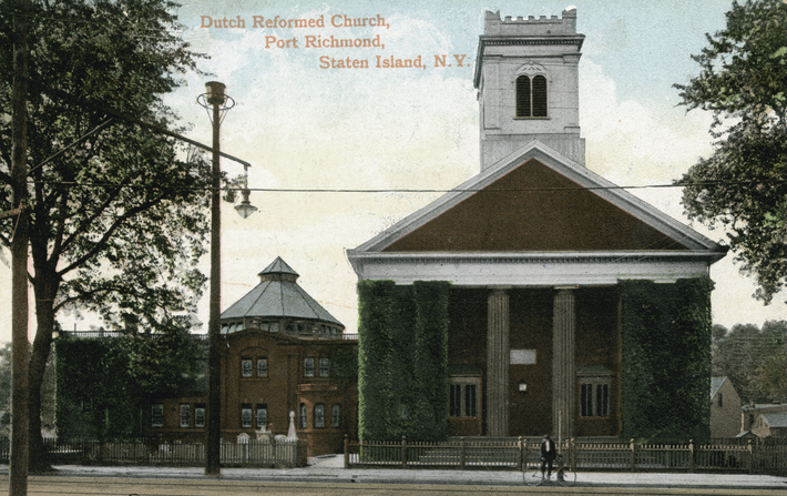
This vintage postcard shows the Port Richmond Reformed Church as it appeared in the early 1900s. Parts of the north and south cemetery sections can be seen on either side of the church (NYPL)
The Reformed Church at Port Richmond is home to the earliest congregation on Staten Island and its surrounding cemetery includes the Island’s oldest public burial ground. Situated just south of the busy intersection of Port Richmond Avenue and Richmond Terrace, this picturesque site—landmarked by the City of New York in 2010—features attractive lawns, historical buildings, artistically significant monuments, and graves of the North Shore’s early Dutch settler families.
In 1715, the Reformed Protestant Dutch Church congregation built their first house of worship at this site, next to the graveyard that had already been in use for at least a decade. Thought to have originated as a private burial ground for the Corson family in the 1690s, the graveyard is referred to in official documents as “the burying place” as early as 1705 and became the burial ground for most families on the North Shore during the 18th century. During the 19th century, the church acquired more land adjacent to the church to expand its burial grounds.
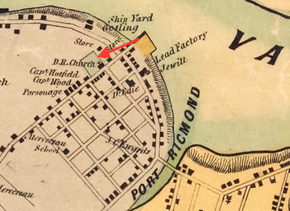
An 1853 map shows the Reformed Dutch Church and cemetery grounds at Port Richmond.
The present church at this site is the congregation’s third, built in 1844. This Greek Revival-style building was enlarged in 1898 with a Sunday school wing added on the south side of the church. The surrounding cemetery is divided into three sections to the north, south, and west of the building complex.
Tombstone of Mary Van Pelt (Richard Arthur Norton, June 2006)
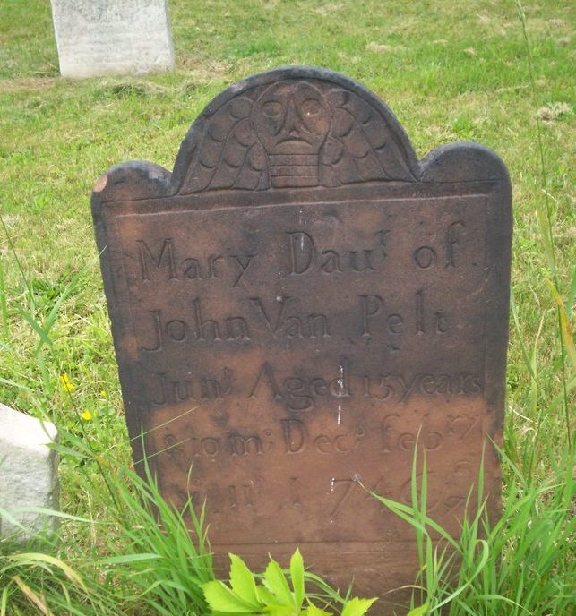
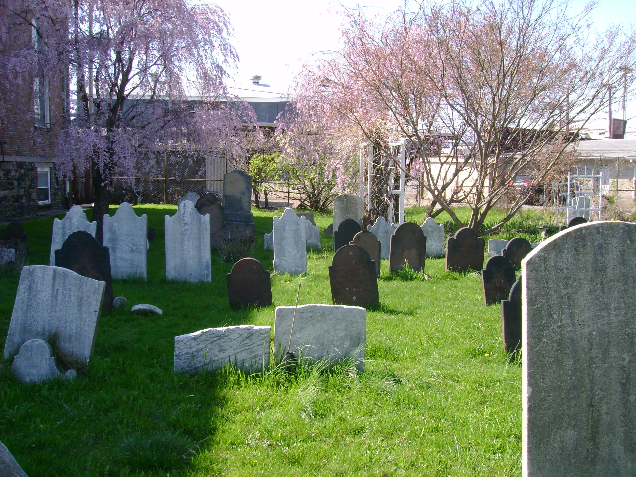
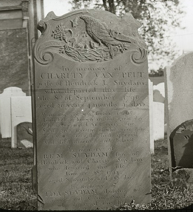
The cemetery section to the north of the church is the oldest and incorporates the original public burial ground of the North Shore’s Dutch settlers. This section is notable for including several finely carved brown and red sandstone gravemarkers that have been ascribed to the workshops of significant New Jersey stone carvers. Of the 224 gravestones here, the oldest with a legible inscription is that of Mary Van Pelt, who died in 1746 at age 15. Her red sandstone marker is topped with a winged death’s head in a style attributed to the “Common Jersey Carver,” an anonymous artisan whose work, dating from the 1720s to 1760s, is well represented in northern New Jersey communities. Other sandstone markers in this section of the cemetery are attributed to carver Ebenezer Price, the most prominent 18th-century stonecutter in the New York-New Jersey region.
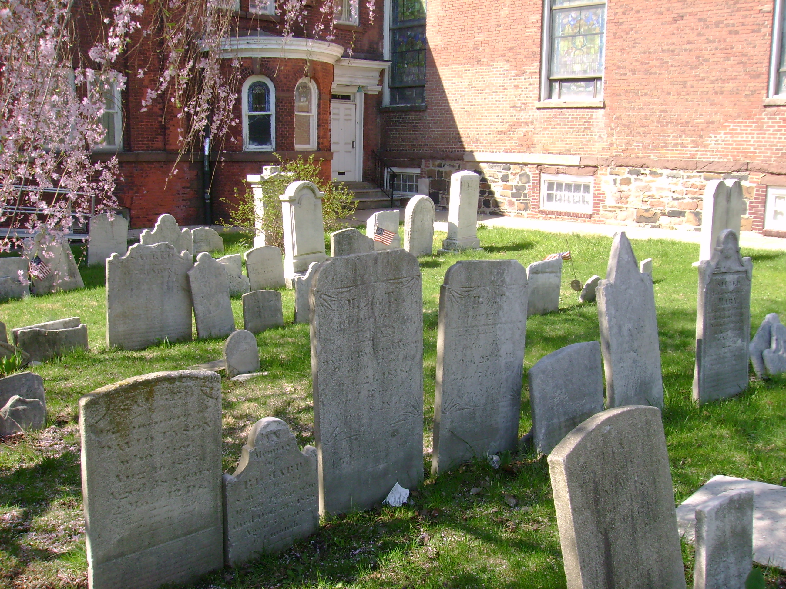
The small cemetery section to the south of the church occupies land donated by Daniel Tompkins in 1816 and includes 105 gravestones dating between 1816 and 1896. Most of the monuments here are marble and mark the graves of members of families such as the Tysons, Merseraus, Jacques, Sinclairs, Haughwouts, Crocherons, Housmans, and Posts. The 1898 Sunday school annex was built over part of this south cemetery; some graves were moved at this time but several rows of graves were left in place and remain beneath the crawl space of the the wing.
A view of the south section of the Port Reformed Church Cemetery, April 2017 (Mary French)
The third cemetery section, not visible from the street, is located behind the Sunday school wing on land purchased in 1833 (and expanded in the 1870s) by the Reformed Church to provide for future burial needs. The 363 markers here, mostly of marble or granite, date between 1834 and 1916. Notable here is the grave of congressman and state senator Judge Jacob Tyson (1773-1848) and the family plots of the Van Name, Houseman, Drake, Kholer, and Post families.
Although the Port Richmond Reformed Church is still an active congregation, no interments have been made in their cemetery grounds for over a century. Historically, the church served as a hub for the Port Richmond community that grew and was built around it. The generations of Staten Islanders that are laid to rest in the church’s grounds are part of this legacy.
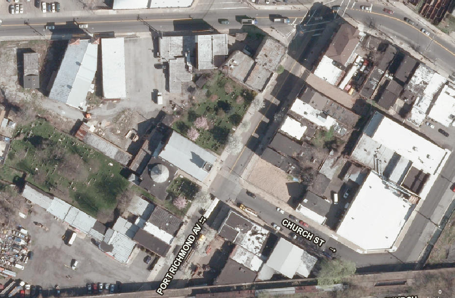
A view of the north section of the Port Reformed Church Cemetery, April 2017 (Mary French)This 2012 aerial image shows Reformed Church building and cemetery grounds on the west side of Port Richmond Avenue, just south of Richmond Terrace (NYCityMap)
Sources: Butler’s 1853 Map of Staten Island; Fairchild Cemetery Manual (1910); “History of the Reformed Church on Staten Island,”Staten Island Historian 16(1) Jan-March 1955; Realms of History: The Cemeteries of Staten Island (Salmon 2006);Reformed Church on Staten Island, Sunday School Building, and Cemetery Designation Report, (Landmarks Preservation Commission 2010); Reformed Church on Staten Island
An 1834 map of Brooklyn depicts the First Reformed Dutch Church of Brooklyn Cemetery on Fulton Street between Smith and Hoyt Streets; the Church can be seen west of the cemetery, on Joralemon Street, where there congregation relocated in 1807
One of New York’s earliest Dutch burial grounds was located where the iconic Abraham & Straus building stands today in downtown Brooklyn. Situated on the south side of Fulton Street near Hoyt Street, the department store site was previously the graveyard of the First Reformed Dutch Church of Brooklyn, established by order of Governor Peter Stuyvesant in 1654. The half-acre cemetery was in use by 1656 and in 1666 the Reformed Dutch Church erected their first house of worship east of the burial ground, in the middle of the colonial highway that evolved into Fulton Street. In 1766, a new church was erected on the same site; this stood until 1807 when the congregation relocated to nearby Joralemon Street. In 1886 the congregation moved again, to the Park Slope location where they continue to worship today.
After the First Reformed Dutch Church of Brooklyn moved to Joralemon Street, they tore down the Fulton Street church but retained the old burial ground. They continued interments there until the 1840s when an ordinance prohibited further burials within Brooklyn city limits. In the winter of 1862-1863, politician and historian Henry Cruse Murphy twice visited the disused Dutch burial ground on Fulton Street and recorded the inscriptions he found on nearly 100 tombstones at the site. Dates of death on the gravemarkers ranged from the 1740s to the 1840s and names included those of some of Brooklyn’s original Dutch settlers, such as Boerum, Remsen, and Barkeloo.
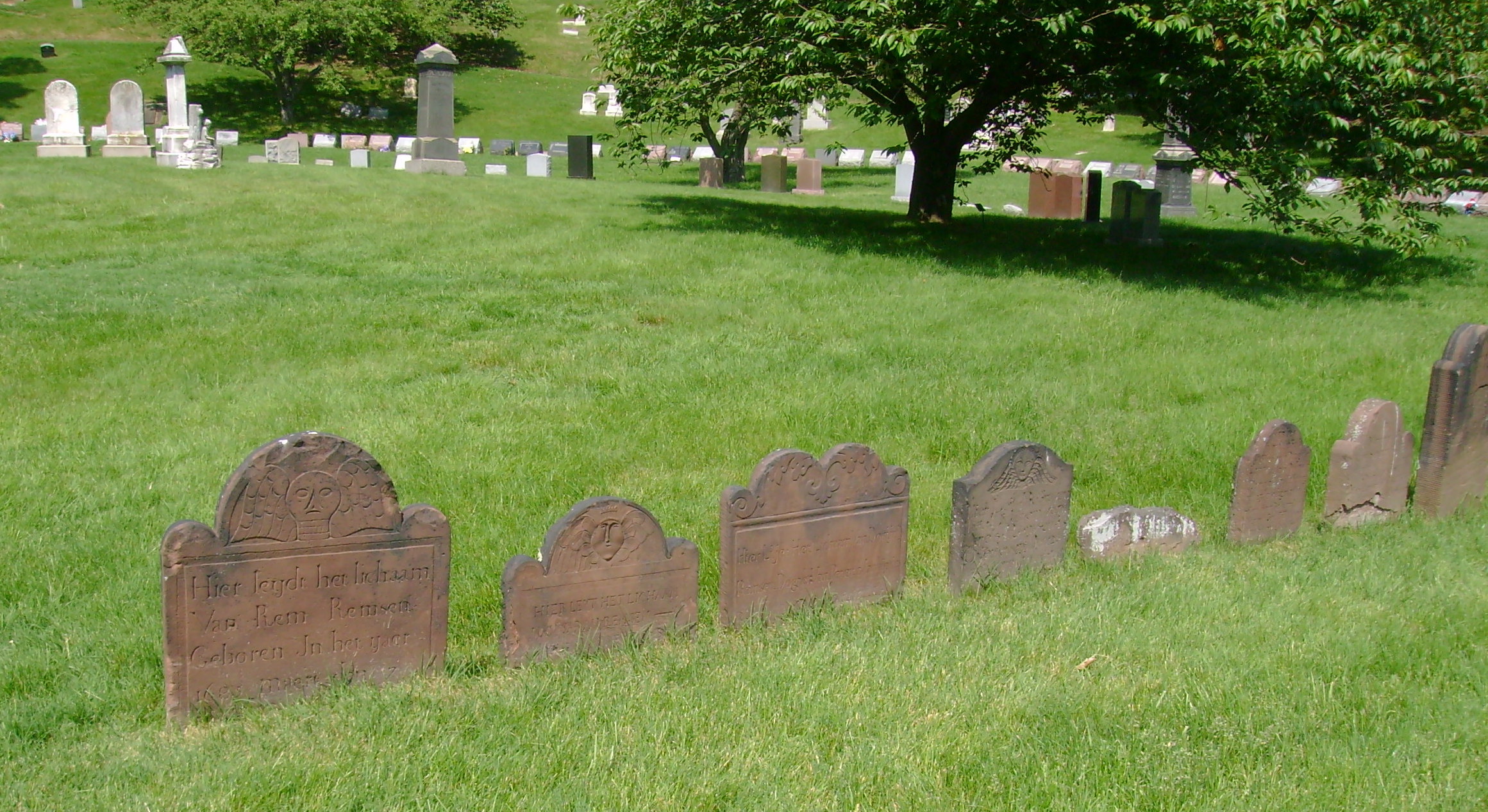
Ancient tombstones mark graves transferred from the First Reformed Dutch Church Cemetery on Fulton Street to the Cedar Dell section at Greenwood (Mary French, May 2016)
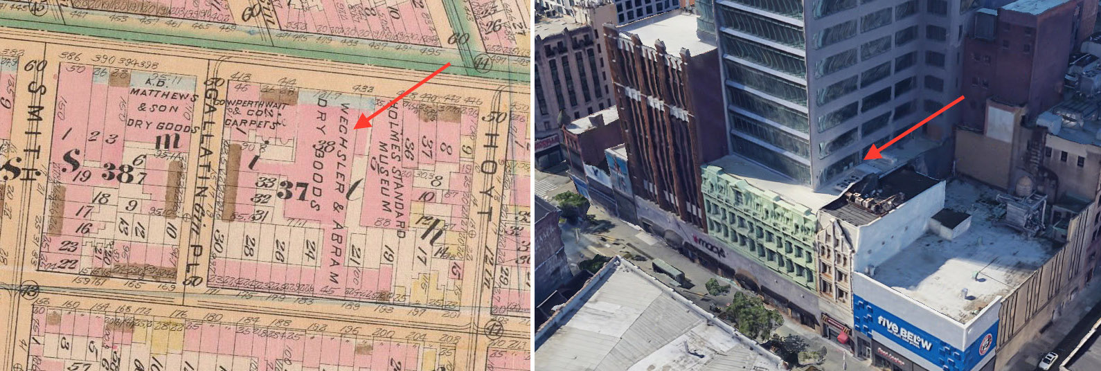
In 1865, the First Reformed Church began making arrangements to remove their Fulton Street cemetery so that the property could be sold. They acquired a large plot of ground at Greenwood Cemetery and in 1866 received permission from the State Legislature to disinter the bodies and relocate them to Greenwood, a process that was completed in 1868. Developer Andrew S. Wheeler subsequently acquired the former burial ground on Fulton Street and in 1873 erected a five-story cast-iron-fronted luxury commercial building on the site. In the 1880s, retailers Wechsler & Abraham purchased the building, rebuilt the interior, and added an extension to create a lavish department store; the company became Abraham & Straus in 1893. Now Macy’s, this building has long been the heart of downtown Brooklyn’s Fulton Mall shopping corridor.
Though gone from its original location in downtown Brooklyn, the essence of the First Reformed Dutch Church of Brooklyn burial ground can be found in Greenwood Cemetery’s Cedar Dell section, where the circular layout of tombstones relocated from Fulton Street makes it one of the cemetery’s signature areas. The distinctive brownstone monuments are some of the oldest at Greenwood and were recently restored as part of a major renovation of the Cedar Dell section. One by one, the old tombstones were unearthed, cleaned, and reset, revealing inscriptions hidden for decades and uncovering reminders of Brooklyn’s forgotten past.
The Cedar Dell section at Greenwood Cemetery, May 2016 (Mary French)Before and after photos of the gravestone of Sarah Bouton (d. 1823) show the transformation achieved by Greenwood Cemetery’s restoration team in repairing and resetting the First Reformed Dutch Church Cemetery monuments at Greenwood Cemetery (Neela Wickremesinghe @brooklyn_conservator)The First Reformed Dutch Church Cemetery in 1855Detail from an 1886 map (left) showing the Wechsler & Abraham department store (later Abraham & Straus) that was built on the First Reformed Dutch Church Cemetery site; a 2022 Google Earth view shows the original store and its expansions, still at at the site today.
Sources: Martin’s 1834 Map of Brooklyn, Kings County, Long Island; Perris’ 1855 Maps of the City of Brooklyn, Pl 28; Robinson’s 1886 Atlas of the city of Brooklyn Pl 2; History of the First Reformed Protestant Dutch Church of Breuckelen, now known as The First Reformed Church of Brooklyn, 1654 to 1896; The Ferry Road on Long Island (Armbruster 1919); “Memoranda Taken from the Tombstones in the Old Dutch Burying Ground in Fulton St…” Long Island Historical Society Quarterly July 1939; “Our Albany Correpondence,” Brooklyn Daily Eagle, Mar 28, 1866; “An Old Landmark Gone,” Brooklyn Union,May 14, 1868; “Old Dutch Burying Ground,” Brooklyn Daily Eagle, Nov 29, 1872;“The Dead…Brooklyn Graves That Have Been Opened,” Brooklyn Daily Eagle, Oct 2 1875; “The Old Dutch Grave Yard,” Brooklyn Daily Eagle, Mar 28, 1881; “Old Burial Ground,” Brooklyn Daily Eagle,” Aug 28, 1886;“Restoring Brooklyn’s Queen of Department Stores,” New York Times, Nov 22, 2019;Ooooh, look at that curve!, The Green-Wood Cemetery, Facebook, Sep 2, 2022; [Sarah Bouton tombstone], @brooklyn_conservator, Instagram, Oct 25, 2022
An 1857 newspaper clipping reports the discovery of human remains at the site of Brooklyn’s early- 19th-century public burial ground
In the years 1811-1812, there was a German physician known as the “Rain-Water Doctor” who practiced in the village of Brooklyn before moving on to Providence, Rhode Island. He was quite famous, and during his time in Brooklyn thousands of people from Manhattan and Long Island came to seek his remedies. The medicines he prescribed were mostly herbs and other natural substances, including rainwater, which he encouraged all of his patients to drink. Among the many who came to Brooklyn to consult the Rain-Water Doctor was Apollos Nicholls of Smithtown, Long Island, who died soon after placing himself under the doctor’s care. The circumstances of Nicholls’ case deeply affected the physician, who erected over his deceased patient’s grave a handsome marble tombstone with the following, unusually long, inscription:
In the mournful instances of human frailty, concording to demonstrate the destiny; also, as a baneful occurrence of both, and of an unshaken resolution and usual disappointment, here lies the no more animated and wasting remains of APOLOS NICOLL, born in Smithtown Ap. 11, 1776 : 14th of the same month 1811, departed and delivered up to the elementary menstrum of dissolution, nought, Resurrection, and Ascension; Conspicuous example of an unavoidable fate, who after his having been tired of experiencing eight months of various diseases, in expection to find alleviation to his painful existence, started in quest of relief, and firm in his resolution notwithstanding an inconsiderable distance contended three weeks in battling against the progressive obstacles of his perilous situation, opposing his design, to reach a dwelling which his delusive confidence had flattered himself to find alleviance, the end of his distress and complicated misery, but unfortunately found the one of his days accelerated by his bold attempt, and both his stranguary dropsical state and the strenuous motion of the last vehicle which conveyed him to the one by whom he eagerly expected to be alleviated and receive his existence prolongation : but vain hope! soon aborted! subject likewise to asthmatical affection by a sudden violent paroxism, effect of the combusted system stimulating the accumulated mass out of its recess, and which completed by obstructing the airy passage speedily produced suffocation, and that fatally; this incident terminated the earthly career, in putting a period to the suffering venturing afflicated; sorrowful consequence which inseparably has condemned the one he so considerately instrusted with his corporeal repair, to become of his disaster passive spectator, instead of a desirous benefactor : predetermined in the witness, which intitially and peremptorily was to sustain the view of such sinister catastrophe the inexorable po..t..ces manifested to only have afforded to their destined victim enough of vital faculty, for reaching the spot whereupon the minutes residue of the last hour was to be exhausted, and for implacably having after the fatal final thread cut off; To memorize such a dismal event, the concern it has caused to the unaccustomed beholder, may this cold stone relating the particular be ofconsolatory nature, for the surviving consort and relatives of the deceased, and help them to be in their privation resigned to the unalterable Supreme Will, and with fortitutde submit to the execution of its irrevocable decree.
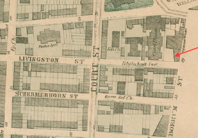
Apollos Nicholls’ grave was in the old public burial ground of Brooklyn, where his tombstone was still standing in 1839 when the above inscription was copied and published by the Long Island Star. This public burial ground, or potter’s field, was located on the northwest corner of Livingston Street and Boerum Place in what is now downtown Brooklyn. When exactly this cemetery was established is not known; it was likely used from the early 1800s until about 1827 when the City of Brooklyn created a new public burial ground at Wallabout Bay.
An 1849 map of Brooklyn shows the Military Garden situated at the junction of Fulton and Joralemon streets; the public burial ground was adjacent to the Military Garden, at the corner of Boerum Place and Livingston Street
The public burial ground at Livingston Street and Boerum Place was a place of interment for the poor, the unknown, and, like Apollos Nicholl, those who died while away from home. Sailors and marines from the Brooklyn Navy Yard were buried here before a naval cemetery was established adjacent to the Yard in the early 1830s. In an 1852 letter to the Daily Eagle, a Brooklynite recalled seeing military burials at the cemetery on Livingston Street and Boerum Place during his schoolboy days. “During the war of 1812,” he writes, “when a large body of Militia was collected in and about Brooklyn, taken from the comforts and endearments of home and suddenly subjected to all the hardships of the camp, sickness prevailed among them, and many died and were here buried. I have often followed the funerals of the soldiers to this burial place.”
The public burial ground was located next to Du Flon’s Military Garden, a pleasure ground that was situated at the junction of Fulton and Joralemon streets from 1810 to 1861. Punch Du Flon describes the Military Garden, and the cemetery that abutted it, in an 1891 letter published in the Daily Eagle. “My father, as you know, was the proprietor of the Military Garden, and it was really the only place of amusement in town in those days. . .We had concerts there and a little theater. At that time there was a burying ground at the corner of Boerum Place and Livingston Street, and that little cemetery bordered my father’s property. It didn’t bother us at all to have a cemetery so close at hand, but there was on one side of the fence a good deal that was grim and on the other a good deal that was merry.”
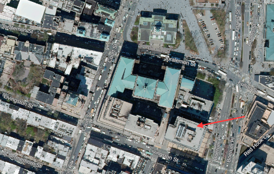
What happened to Brooklyn’s old public burial ground is unclear. Evidently, the City of Brooklyn sold the property in the 1850s, but no record has been found indicating that authorities arranged for the removal of remains from the site before it was redeveloped. When workmen excavated the property in 1857, they found human remains and portions of coffins and headstones. These were reportedly carried off with rubbish from the site. Another relic from the cemetery was found in 1861 when workmen redeveloping the Military Garden property found a gravestone with the name “Peter Taylor.” By the late 1860s, a county courthouse stood on the former Military Garden and the public burial ground was covered by stables and a gymnasium. Today office buildings are at the site of Brooklyn’s early-19th-century public burial ground, where a monument with the Rain-Water Doctor’s 400-word epitaph to a lost patient once stood.
The redeveloped Military Garden and public burial ground sites are depicted on this 1867 mapA 2018 aerial view of the former site of the Brooklyn public burial ground at Livingston Street and Boerum Place
Sources: Map of the City of Brooklyn (Colton 1849); Plan of New York City, from the Battery to Spuyten Duyvil Creek, Sheet 1 (Dripps 1867); A History of the City of Brooklyn including the Old Town and Village of Brooklyn, the Town of Bushwick, and the Village and City of Williamsburgh, Vol 1 (Stiles 1867) & Vol 2 (Stiles 1869); “Report of the Overseers of the Poor in the Town of Brooklyn,” Long Island Star, Mar 29, 1820; “Report of the Overseers of the Poor in the Town of Brooklyn,” Long Island Star, Mar 28, 1821; “Common Council,” Long Island Star, May 16, 1839; “Rain-Water Doctor,” Long Island Star, Jun 6, 1839; “For the Brooklyn Daily Eagle” Brooklyn Daily Eagle, Jan 10, 1852; “Old Potter’s Field,” New-York Daily Tribune, Mar 26, 1857; “Rattle His Bones. . .” Brooklyn Daily Eagle, Mar 25, 1857; “While Excavating. . .” Brooklyn Evening Star, Mar 25, 1857; “A Mortuary Relic,” Brooklyn Daily Eagle, Dec 7, 1861; “The Dead. . . Brooklyn Graves that Have Been Opened” Brooklyn Daily Eagle, Oct 2, 1875; [Letter to the Editor], Brooklyn Daily Eagle, May 15, 1881; “Shattered Napoleon’s Head,” Brooklyn Daily Eagle, Feb 1, 1891
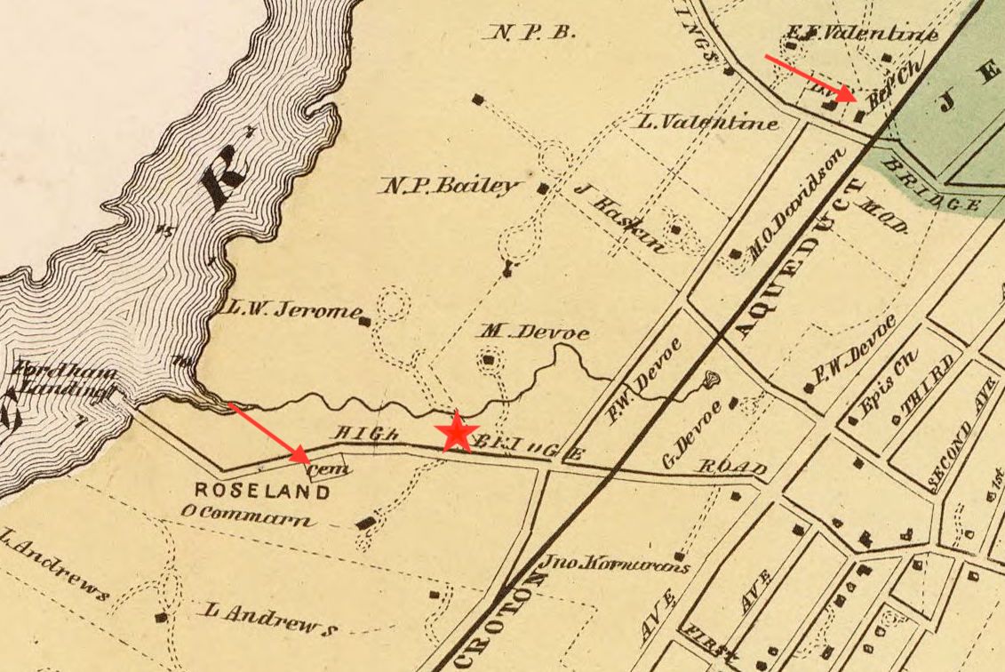
This detail from an 1868 map shows the two burial places connected with the Fordham Manor Reformed Church—the old public burial ground on Highbridge Road (today’s Fordham Road) and the Church property on the north side of Kingsbridge Road. Red star denotes approximate location of the original church site on Fordham Road, across from the old cemetery.
The modern Fordham Manor Church on Reservoir Avenue near West Kingsbridge Road is the successor to one of the earliest congregations in the Bronx. In 1696, the Dutch Reformed Church organized a society in the area then known as the Manor of Fordham. In 1706 they built their first church on the north side of Fordham Road, in present-day Devoe Park. After this building was destroyed in the Revolutionary War, a new church was built in 1801 on property about a mile north, at Kingsbridge Road. This was the first of three edifices to stand on that site; the second church was built in 1849, and the present building was erected in 1940. During the 18th and 19th centuries, the Dutch Reformed Church of Fordham Manor used two local cemeteries to bury their dead—a public burial ground near their original house of worship on Fordham Road and a small cemetery next to their church on Kingsbridge Road.
Public Burial Ground, Fordham Road
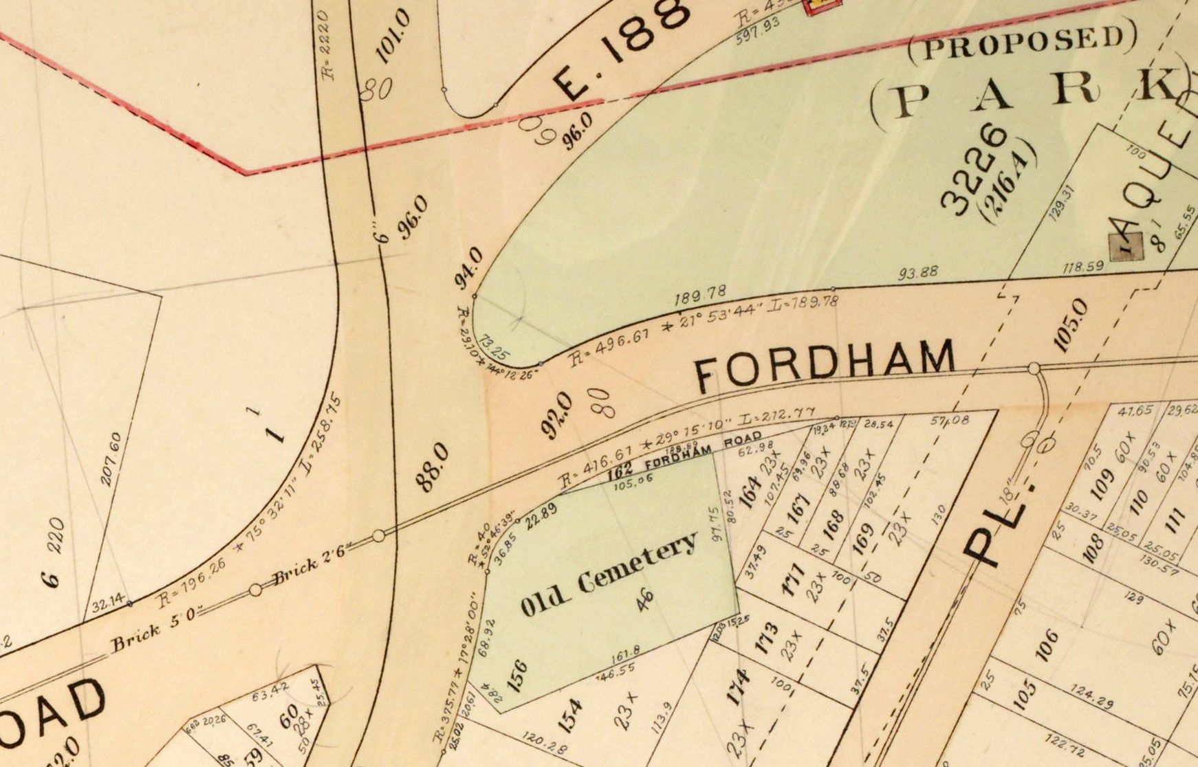
Until 1909, an “ancient Dutch burying ground” stood at the southeast corner of today’s Sedgwick Avenue and West Fordham Road, where an apartment building is located today. Exactly when this cemetery was established is not known; it may have been used as far back as the 1600s when Dutch families began to settle in the area. Deeds dated before the Revolution refer to the one-and-a-half-acre cemetery as a public burial ground and it was known to have been used as a free burial ground by local authorities into the 19th century. During its early history, this public cemetery was linked with the Dutch Reformed church that originally stood 200 yards from it, on the opposite side of Fordham Road. After the congregation moved up to Kingsbridge Road in the early 1800s, their ties with the village burial ground were eventually broken. By the late 1800s, the public burial ground at the intersection of Sedgwick Ave and Fordham Road was known to many locals as the “Berrian Cemetery,” for one of the families who owned land surrounding the cemetery and who had interred a number of their kinfolk in the graveyard.
A 1901 map depicts the old burial ground at the intersection of Fordham Road and Sedgwick Avenue
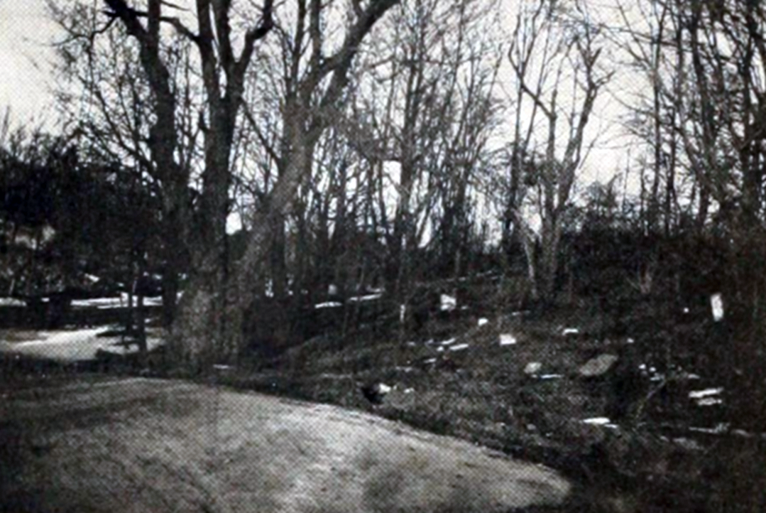
One 19th-century historian estimated that perhaps 1,000 people were interred in the cemetery on Fordham Road and Sedgwick Avenue. Genealogists who visited the site in the 1870s and 1880s recorded tombstones with family names including Berrian, Valentine, Cromwell, Laurence, DeVoe, Hart, and Rowland. The earliest date found was 1810 and the latest was 1863. Less than two dozen graves had headstones with identifiable inscriptions; many more graves were designated by rough, flat stones with no markings. Guarding the graveyard was a magnificent willow tree, over 20 feet in circumference, which stood at the edge of the property.
1906 view of the burial ground at Fordham Road and Sedgwick Avenue, showing toppled tombstones and the huge willow tree that sheltered the site (Comfort)
By the turn of the century, the cemetery was neglected and partially destroyed by street construction. The western portion of the graveyard was taken by the city in 1874 for the opening of Sedgwick Avenue and a section on the north part of the property was cut off in the 1890s when Fordham Road was widened. Many families had arranged to have their family members’ remains moved to other cemeteries, the numerous disinterments causing further disturbance to the burial ground. Newspaper articles describe it as a place of “sad havoc,” a mass of broken tombstones, brush, and rubbish. Ownership and responsibility of the property was a tangle of uncertainty until the early 1900s when a court-appointed referee ruled that the Camman family, who had acquired the Berrian farm in 1852, could sell the cemetery property once they arranged for removal of the remains. Workmen excavated the cemetery in the winter of 1908-1909 and packed up any bones they found. The exhumed remains were reburied in a plot at Ferncliff Cemetery in Westchester. In 1927 a six-floor apartment building, still present, was erected on the site of the old Dutch burial ground of Fordham Manor.
Fordham Manor Church Cemetery, Kingsbridge Road
In 1801, Dennis Valentine, Sr., donated land for construction of a new Dutch Reformed Church at the Manor of Fordham. The plot, 90 feet deep and 74 feet across, was located near the northwest corner of what is now Kingsbridge Road and Reservoir Avenue. In 1836, the church appointed a committee to look for land for a burial place. The congregation apparently continued to use the old burial ground at Fordham Road and Sedgwick Avenue for some time after they moved to their new location, the donation having included only enough property to accommodate the building. In 1849, Dennis Valentine, Jr., donated additional lands adjacent to the 1801 church property to provide sufficient ground for erection of a new house of worship and for a burial ground. The new building was erected on the property immediately adjoining the 1801 structure and facing Kingsbridge Road. Land to the rear of the church was used for a cemetery. The last known interment here was in 1884.
1901 map depicting the Fordham Manor Reformed Church building on Kingsbridge Road, with the cemetery behind it
Several families had vaults in the church cemetery, including members of the Valentine, Briggs, and Archer clans. After Woodlawn Cemetery was established in 1863, each of these families acquired plots there and had the remains of their family members relocated to Woodlawn from the church cemetery. Notable among the removals from the Valentine family vaults were the remains of Virginia Clemm, wife of Edgar Allan Poe. In 1847, Virginia Clemm died while she and her husband were living in a rented cottage (preserved as Poe Cottage) on the Valentine farm. She was laid to rest in the private vault of Dennis Valentine, Sr., which he built in the 1830s on his land adjacent to the 1801 Fordham Manor Church building. Although officially separate from the church burial ground, it was generally considered part of the cemetery. When the Valentine family removed the remains from their vaults in the late 1870s, Virginia Clemm’s remains were taken to Baltimore for reburial alongside her husband, who died in 1849.
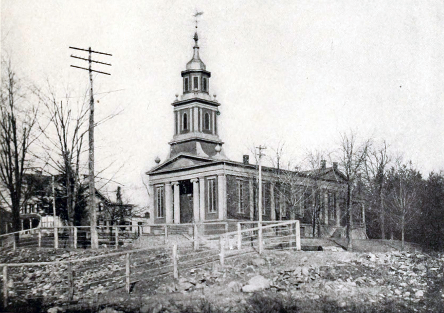
A 1912 view of the Fordham Manor Reformed Church building on Kingsbridge Road, erected in 1849. The church cemetery, located to the rear of the building, is not visible (Jenkins)
In August of 1912, the journal Genealogy published inscriptions from the Fordham Manor Reformed Church Cemetery. The burial ground behind the church was described as “a neglected corner plot, overgrown with weeds, where a few tombstones, some badly broken, still remain.”Inscriptions from the 20 tombstones found at the site included members of the Poole, Webb, Archer, Horton, Corsa, and Webb families. The earliest dated to 1843 and the latest to 1870.
In the early 1920s, the Fordham Manor Reformed Church authorities made plans to purchase a nearby house and have it moved to the church property for use as a parsonage. Before this could be done, it was necessary to clear the cemetery of bodies. After receiving the necessary permissions, in 1925 the remains of 32 people were exhumed from the cemetery behind the church and reburied in a plot at Kensico Cemetery in Westchester. In 1940, the Fordham Manor Reformed Church demolished their 1849 church building and the parsonage, sold the southern portion of their property along Kingsbridge Road, and built a new edifice on the northern part of their land, where their cemetery once stood. The 1940 building, which faces Reservoir Road, is the home of the present Fordham Manor Church, now a nondenominational congregation.
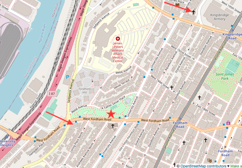
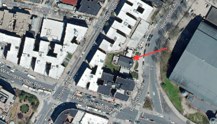
A modern map with arrows denoting the former site of the cemetery at Fordham Rd and Sedgwick Ave and the present Fordham Manor Church at Reservoir Ave near Kingsbridge Rd, on the site of the former church cemetery. Red star denotes the approximate location of the original church site on Fordham Road (OpenStreetMap)2018 aerial view of the apartment building on the former cemetery site at Fordham Rd and Sedgwick Ave (NYCThen&Now)2018 aerial view of the present Fordham Manor Church property on Reservoir Avenue, formerly the site of the church cemetery (NYCThen&Now)
Sources: Beers’ 1868 Atlas of New York and Vicinity, Pl 8; Hyde’s 1901 Atlas of the Borough of the Bronx, Pl 25 & 32; Genealogy of the DeVeaux Family (De Voe 1885); History of Bronx Borough (Comfort 1906); The Story of The Bronx (Jenkins 1912); History of Fordham Manor Reformed Church, 1696-1946 (Attwood 1946); “Old Burial Grounds in Westchester Co, NY,”NYG&B Record 20 (2) 1889; “Notes & Queries,” NYG&B Record 22 (4), 1891; “Neglected Graves at Fordham Heights,” Evening Telegram, May 7, 1892; “A Neglected Cemetery,” New York Times, Dec 22, 1901; “Facts About the Berrian Cemetery,” New York Times, Dec 30, 1901; “Old Historic Cemeteries,” Daily Argus (Mount Vernon, NY) Jan 9, 1905; “Historical Cemetery Despoiled,” Magazine of American History, 36 (11), Nov 1908; “Poole Family Burials,” Genealogy 2(6), Aug 10, 1912; “From a New York Cemetery,” Genealogy 2(7), Aug 17, 1912; “Church in Bronx to Have New Home,” New York Times, Feb 17, 1940; Cemeteries of the Bronx (Raftery 2016)
A view of New Utrecht Cemetery, ca 1915. Metropolitan Baptist Church is in the background. The Dubois-Crane obelisk, toppled by Hurricane Floyd in 1999, can be seen rising above the other tombstones at the northeast corner of the cemetery (MCNY)
Located on a quiet residential block in the Bensonhurst section of southwestern Brooklyn, the old New Utrecht Cemetery is a relic of a time when this locale was the heart of one of the six original towns of Brooklyn. The one-acre burial ground, at the corner of 16th Avenue and 84th Street, was established in 1654 when the Dutch settled the village of New Utrecht. The cemetery was centrally located on the village’s main thoroughfare (now 84th Street) and the town’s first house of worship, the New Utrecht Reformed Dutch Church, was constructed at its northeast corner in 1700. Although owned by the church, the cemetery was traditionally a community burial place where any inhabitant of New Utrecht could be buried regardless of religious affiliation.
A finely-carved, early tombstone at New Utrecht Cemetery, photographed ca. 1910 (BHS)
In 1828 the Reformed Dutch congregation tore down their building adjacent to the cemetery and built a new church two blocks away, at 84th Street and 18th Avenue, where it is today. In 1899, St. John’s German Lutheran Church (later Metropolitan Baptist Church) was erected where the Dutch church formerly stood; this building still stands at the northeast corner of the cemetery. Clustered closest to the church are the family plots of the earliest New Utrecht families, including the Van Brunts, Cortelyous, Cowenhovens, Cropseys, and Bennetts. Further from the building are plots for families who settled in the area in the 19th century a later—many with Scotch-Irish and Italian surnames. Behind the church is an unmarked area of the cemetery where American Revolutionary War soldiers are said to be buried.
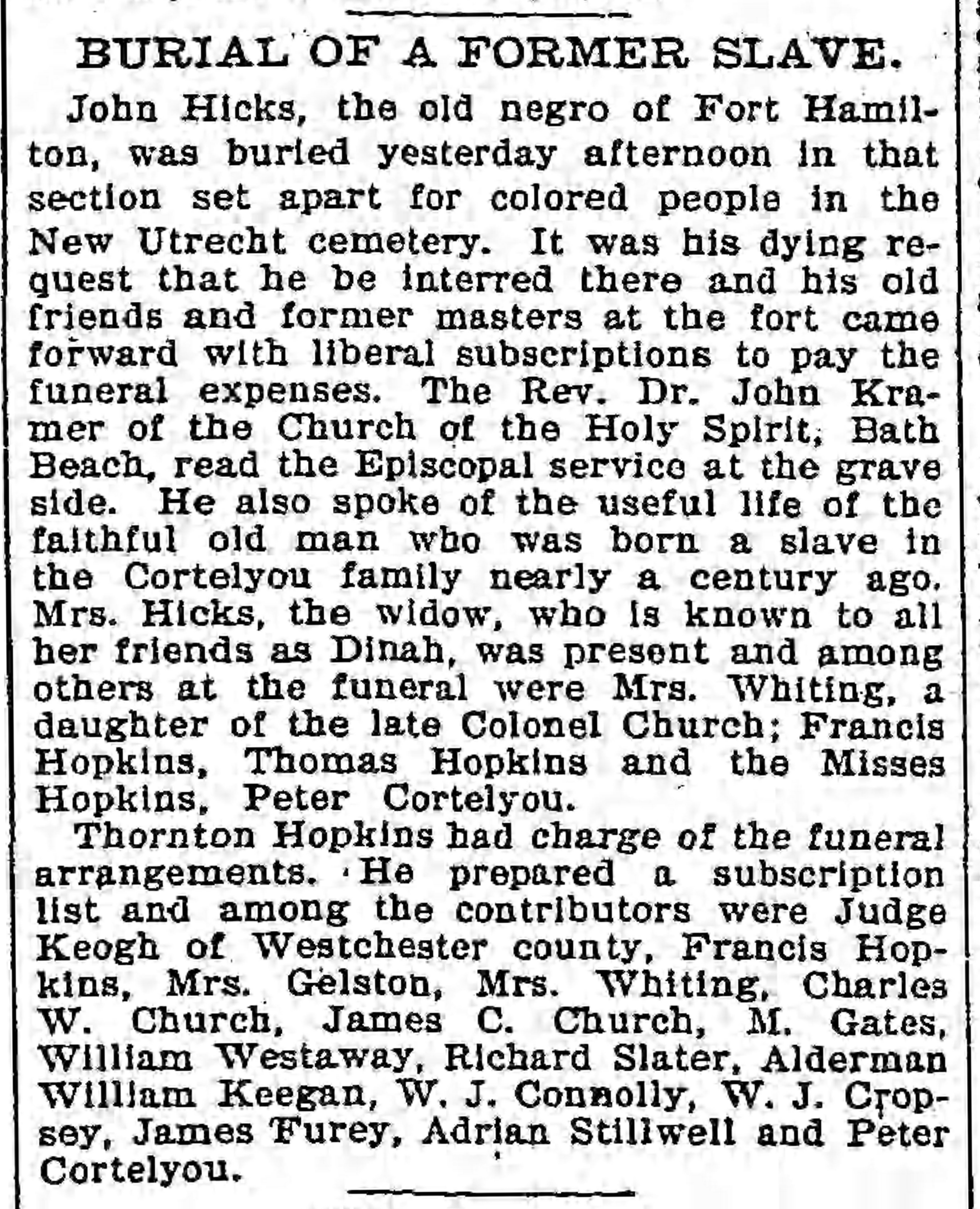
1896 newspaper clipping reporting John Hicks’ burial at New Utrecht Cemetery
In the northwest corner of the cemetery, near the intersection of 16th Avenue and 84th Street, is another section unmarked by gravestones. This is the old “slave burying ground,” once fenced off the rest of the grounds, where members of the local African American community were buried into the 20th century. Though the names of most of those interred here are unknown, historical obituaries provide information for a few. Among them is John Hicks, a former slave of the Cortelyou family, buried “in that section set apart for colored people in the New Utrecht Cemetery” when he died in 1896. Also here is Anthony Thompson, who died in the Brooklyn Home for Aged Colored People in 1911 at age 98. Born enslaved at Paterson, New Jersey, Thompson escaped by running away at age 16, eventually settling in New Utrecht and fathering 13 children.
This photo from a 1900 newspaper article depicts the “slave burying ground” at the northwest corner of New Utrecht Cemetery
At the northeast corner of the cemetery is a large granite obelisk memorializing physicians James E. Dubois and John L. Crane, who died of yellow fever while treating local victims of the disease during an 1856 epidemic. The seven-ton monument, which previously stood 18 feet high, broke off during Hurricane Floyd in 1999 and has lain on the ground since then. The townsmen of New Utrecht resolved to erect the monument at a meeting in December of 1856, where they made the following declaration:
That by the heroic courage and benevolence displayed by them in visiting all having the yellow fever, both rich and poor, until they were taken down themselves with that awful disease, thus sacrificing their own lives for their fellow suffers; resolved, therefore, that as they have endeared their memory to us, their neighbors and friends, we will erect a suitable monument to their many virtues.
Approximately 1,300 people have been interred in New Utrecht Cemetery during the past three centuries. Although the cemetery is still active, burials there are now rare.
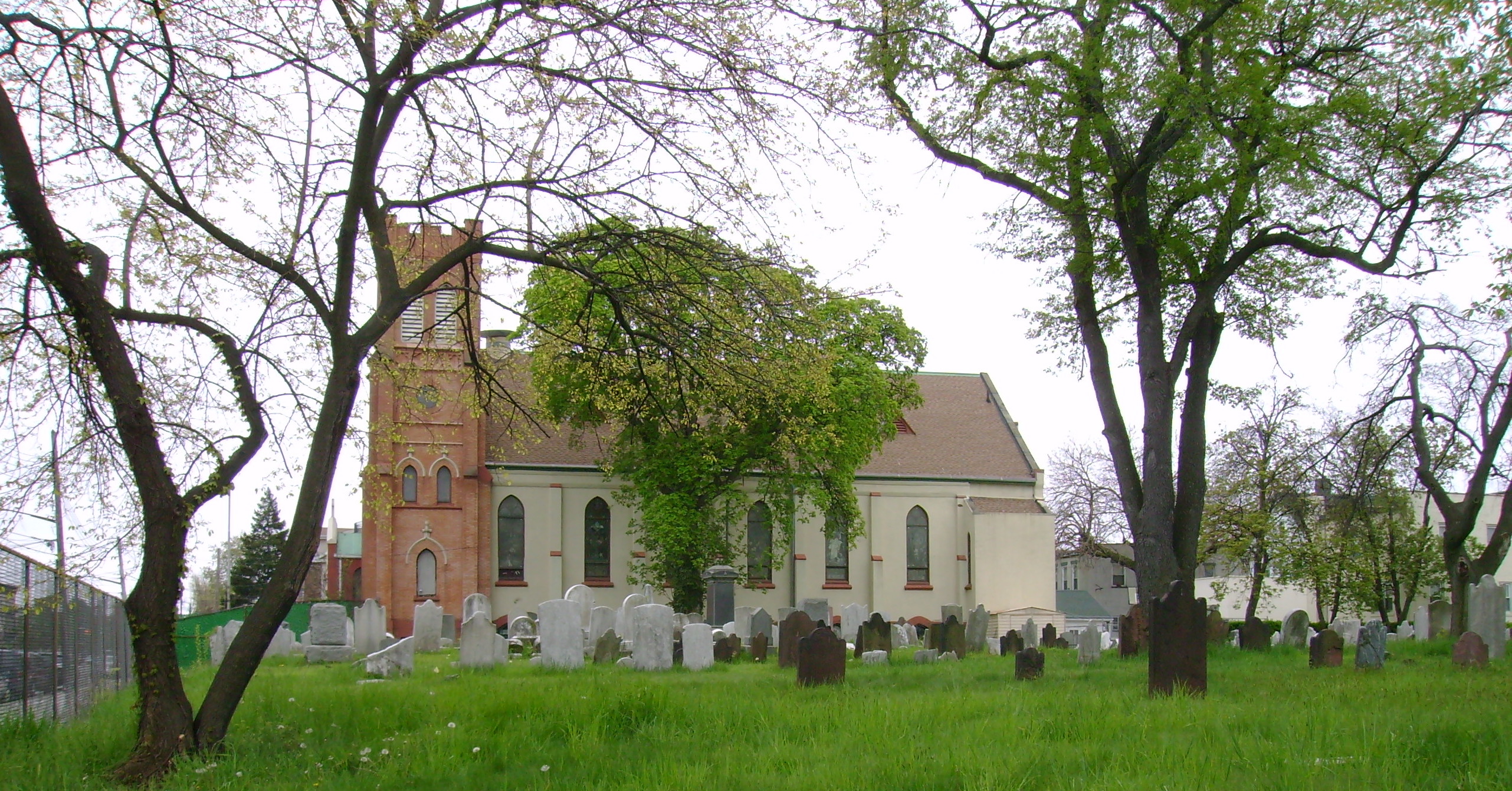
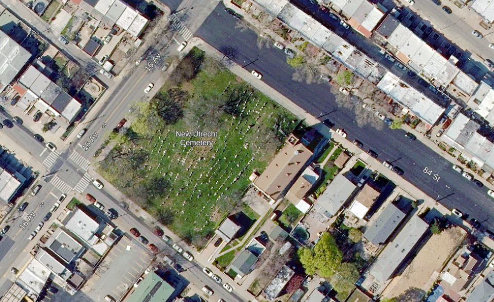
View of New Utrecht Cemetery, May 2016 (Mary French)A 2018 aerial view of New Utrecht Cemetery at 84th St and 16th Ave in Bensonhurst (NYCThen&Now)
Sources: Reminiscences of Old New Utrecht and Gowanus (Bangs 1912); New Utrecht Reformed Dutch Church Cemetery Designation Report (Landmarks Preservation Commission 1998); “Respect to the Martyrs,” Brooklyn Daily Eagle, Dec 2, 1856;“Burial of a Former Slave,” Brooklyn Daily Eagle, Jun 17, 1896; “The Story of New Utrecht,”Brooklyn Daily Eagle, Apr 1, 1900; “New Utrecht Village’s Old Dutch Burying Ground,” Brooklyn Daily Eagle, Sep 23, 1900; “Old Church Graveyard in Sad State of Neglect,” Brooklyn Daily Eagle, Dec 24, 1905; “Obituary—Anthony Thompson,”Brooklyn Daily Eagle, Jun 1, 1911; “Stones in New Utrecht Cemetery Crumbling, Brooklyn Daily Eagle, Mar 23, 1931; “A Burial Ground for the Mighty, Laid Low by Weeds,” New York Times, Dec 2, 2007