On March 31, 1823, New York City’s Common Council passed the first of a series of laws banning interments in lower Manhattan, an action that was part of a movement in American cities that sought to promote public health by prohibiting burial of the dead in dense population centers. Though the ban was supported by those who regarded the numerous churchyards scattered throughout lower Manhattan as foul-smelling, unattractive eyesores that spread diseases, it was opposed by congregations and by families who had invested in purchasing lots and vaults in their churchyards. The opposition, who viewed the ban as an attack on private property and the rights of churches, was so strong that the Common Council reconsidered the measure twice over the next two years, both times reaffirming its original prohibition. However, the controversy demonstrated that the city needed to offer an alternative to those that had been deprived of a burial place as a result of the new interment law.
The Evening Post reports the laying of the cornerstone of the wall that would enclose the new burial ground, Oct 1823
At the same March 1823 meeting where they passed the interment law, the Common Council appointed a special committee to select a “Suitable Site for a public Burial Place to be called the City Burying ground.” This committee soon presented reports on the development of the new city burial ground, which would accommodate the “different religious congregations of the City,” as well as individuals “who may choose to select particular Spots for their families;” ground in the cemetery would also be reserved for the interment needs of the city’s “numerous poor.” The site selected for the municipal burial ground was part of common lands belonging to the city, located a little over three miles from City Hall, about 10 acres bounded by Fifth and Sixth avenues and 40th and 42nd streets. The city spent approximately $10,000 preparing the new cemetery, building 10 public burial vaults in the grounds, planting rows of weeping willows and elms, and enclosing the site with a four-foot-high stone wall that was topped with a “strong mortised fence, five feet high, made of Locust posts and the best Georgia pine.”
An 1825 call for proposals to construct vaults in the new burial ground
Despite the city’s efforts to provide a handsome municipal burial ground that could be used by all its citizens, the project never attracted middle- or upper-class New Yorkers and there is no evidence that congregations or families ever acquired lots or vaults in the city cemetery. The project was abandoned by the late 1820s; although the land is said to have been used as a potter’s field, reports from the 1850s state that the ground had been found to be too wet to be used for burials and remained wasteland until 1837, when it was appropriated for reservoir purposes. The city subsequently constructed the Croton Distributing Reservoir on the eastern portion of the site, while the western side became a public park known as Reservoir Square. In 1884 Reservoir Square was renamed Bryant Park; in 1899 the city demolished the reservoir and replaced it with the New York Public Library.
The 1823 public cemetery site is now the location of Bryant Park and the New York Public Library (NYCityMap)
Sources: Goodrich’s 1828 Plan of the City of New York and of the Island; Minutes of the Common Council of the City of New York, 1784-1831 (City of New York 1917), 12:811-812; 13:116-118; 14:209-212; 15:245; The Iconography of Manhattan Island: 1498-1909 (Stokes 1915-1928), 3:715, 968, 975; The Last Great Necessity: Cemeteries in American History (Sloane 1991), 34-40; “Proceedings of the Common Council,” New York Spectator, Apr 4, 1823; “Proceedings of the Common Council,” New York Spectator, Jun 13, 1823; “New Burying Ground,” New York Evening Post, Oct 15, 1823; “New Burying Ground,” New York Spectator, Oct 15, 1823; “Corporation Proceedings,” New York Evening Post, Dec 22, 1824; “Proceedings of the Common Council,” New York Evening Post, Dec 27, 1824; “To Masons,” New York Evening Post, Jul 2, 1825; “The New York Crystal Palace,” New York Herald, Jun 3, 1856; “The Removal of the Crystal Palace,” New York Herald, Nov 29, 1856
Detail of Bridges 1811 map of the city, showing Greenwich village; approximate boundaries of the potter’s field are indicated in red
In April 1797, New York City authorities decided to purchase a piece of property “bounded on the Road leading from the Bowery Lane at the two Mile Stone to Greenwich” to replace the public burial ground then in use at Madison Square Park. The property was seen by many as a good choice for the new potter’s field—it was in a rural area north of the populated city but a convenient distance to the Almshouse in City Hall Park, to the public hospital at Bellevue on the East River, and to the new state prison just west on the Hudson River. One group, however, was incensed by the plan—affluent New Yorkers who had country retreats in Greenwich village. The burial ground would not only abut the suburban homes of many of the city’s elite, but it was contiguous to the only road leading westward from the Bowery turnpike to Greenwich, so they and their fashionable visitors would have to suffer the slow-moving wagons carrying bodies to the site.
Fifty-seven owners of residences in the vicinity, including Alexander Hamilton, immediately sent a letter of protest to the Common Council, stating that the burial ground would “lie in the neighborhood of a number of Citizens who have at great expense erected dwellings on the adjacent lots for the health and accommodation of their families during the summer season, and who, if the above design be carried into execution, must either abandon their seats or submit to the disagreeable sensations arising from an unavoidable view of and close situation to a burial place of this description destined for the victims of contagion.” The petitioners offered to buy another piece of land in exchange for the planned site, but their proposal was denied. The city proceeded with preparing the new burial ground, bounded by Greenwich Lane on the north, Fourth street on the south, Wooster Street on the east, and Minetta Creek (which ran southwest from the foot of Fifth Avenue to the corner of MacDougal and Fourth streets) on the west. This property forms approximately the eastern two-thirds of today’s Washington Square Park.
An 1817 survey of the potter’s field, showing the Scotch Presbyterian burial grounds at the northeast corner (Geismar 2005)
By November 1797, the new burial public burial ground was ready—fenced with “good posts and rails” and planted with trees—and the city ordered the keeper to commence interments there instead of at the old Potter’s Field at Madison Square Park. The keeper, who lived in a house in the northeast corner of the seven-acre site, dug graves, maintained the grounds, and performed another important function—protecting the cemetery from grave robbers. During the 18th and 19th centuries, medical students and physicians were in desperate need of cadavers for their training and research; with no mechanism in place to supply them with fresh corpses, they resorted to body snatching—a crime so common that almost every prominent physician in the city confessed to having taken part. They often pilfered remains from the city’s most vulnerable graveyards—the African burial grounds and potter’s fields, where their raids were less likely to arouse public outrage.
Excerpt from the New York Evening Post report of an 1824 attempt to steal bodies from potter’s field
John McKenzie, Keeper of the Potters Field in 1808, was dismissed from the position when he confessed to “conniving at the disinterment and taking away of dead bodies” from the burial ground. One of his successors in the position, William Schureman, was a more faithful servant to the dead—at about 3 o’clock on an April morning in 1824, Schureman “suspected that some person had entered the field for the purpose of removing the dead, and after sending for two watchmen, and calling his faithful dog, he went to ascertain the fact.” His suspicions were confirmed when he arrived at a burial pit containing about 10 coffins that had been uncovered; when the person concealed in the grave refused to show himself, Schureman sent his dog into the pit. Instantly, “a tall, stout fellow made his appearance, and took to his heels across the field.” The grave robber was eventually secured by the watchmen and sentenced to six months in prison. Reporting the story, the New York Evening Post cautioned, “the young gentlemen attending the medical school of this city, will take warning by this man’s fate. They may rest assured that the keeper of Pottersfield will do his duty and public justice will be executed upon any man, whatever may be his condition in life, who is found violating the law and the decency of Christian burial.”
Headstone of James Jackson, a 1799 victim of yellow fever; the headstone was found in Washington Sq Park in 2009 (New York Times)
The potter’s field was a burial place not only of “strangers and paupers,” but citizens, rich and poor alike, who died of yellow fever. In the summer of 1798, the disease returned to the city in such proportions it became known as the Great Epidemic; of the 2,000 New Yorkers who perished, about 660 were buried in the potter’s field. The following year, and in subsequent outbreaks, churches were forbidden from burying yellow fever victims in their burial grounds; all those succumbing to it were interred in the potter’s field. In an address delivered to the New-York Historical Society in 1857, John W. Francis describes the potter’s field at Washington Square as “our Golgotha during the dreadful visitations of the Yellow Fever in 1797, 1798, 1801, and 1803…many a victim of the pestilence, of prominent celebrity, was consigned to that final resting-place on earth, regardless of his massive gains, or his public services.”
In addition to serving as burial ground for the indigent, the unknown, and those dying of contagious diseases, the potter’s field was the location of a number of church plots, which lined the burial ground’s eastern edge. Among these church plots were several at the northeastern corner of the potter’s field belonging to congregations of the Scotch Presbyterian Church, and two 50-foot-square plots set aside for the African Methodist Episcopal Zion Church and Asbury African Church.
By the 1820s, some 20,000 bodies had been laid to rest in the potter’s field and the area surrounding the burial ground—once farm fields and country estates—had transformed into a thriving suburb of the city. Houses and shops lined the blocks immediately south of the burial ground; wells were dug, pumps installed, and streets regulated. “The present Pottersfield is nearly filled, and by Spring it will be necessary to remove it to some other place,” the city council reported in December 1824; a month later, they announced, “the time has arrived when interments should be interdicted in a part of Our City so rapidly improving as that in the vicinity of the present Pottersfield.” In 1825, the burial ground was closed and ordered filled and leveled. The city acquired additional land on the west side of the potter’s field to give the property a uniform shape, and in 1828 the site was described as “a beautiful public square, called Washington Square, which is also used as a military parade ground.” By 1878 it was a public park.
Map showing location of burial vault found at the northeastern corner of the park in 1965; believed to be part of the Scotch Presbyterian burial grounds
When the city was in the process of creating a public square from the burial ground, the Common Council declared “it is not the intention of this Board to disturb any of the graves within these grounds nor will there be any absolute necessity for such a measure.” They acknowledged that among those buried there were “many connected with our most respectable families” and said they would not think of “disturbing the numerous remains deposited there.” Despite these noble intentions, remains of those resting under Washington Square Park have been disturbed a number of times over the years.
Workmen digging the foundation for the park’s iconic Washington Memorial Arch at the Fifth Avenue entrance in 1890 unearthed coffins, skeletons, and headstones, two bearing the date 1803. In 1941, the New York Times reported more “grim human relics of the eighteenth and nineteenth century” were encountered by WPA laborers who found human remains during excavations for a sewer on the north side of the park. During utility excavations at the northeastern corner of the park in 1965, Con Edison workmen broke through the domed roof of an underground burial vault containing several coffins and “at least 25 skeletons;” this likely was part of the burial grounds of the Scotch Presbyterian Church.
An intact burial uncovered in the park in 2008 (Geismar 2009)
And remains representing at least 31 individuals, including 16 intact graves, were discovered during archaeological work connected with renovations at the park between 2009 and 2013. Also discovered during these excavations was a beautifully-engraved brownstone marker found in the southwest quadrant of the park. “Here lies the body of James Jackson,” the inscription on the three-foot-tall headstone says, “who departed this life the 22nd day of September 1799 aged 28 years native of the county of Kildare Ireland.” Though no human remains were found associated with the headstone, research confirmed that Jackson was a victim of yellow fever and that’s how he—and his finely-made headstone—came to rest in the potter’s field.
Update June 2021: Human remains uncovered during construction at Washington Square Park between 2008 and 2017 were reburied inside the park in March 2021. The partial remains were placed in a wooden box and buried five feet below grade in a planting bed near the Sullivan Street entrance. The reburial site is marked with an engraved paver near the Sullivan Street and Washington Square Park South entrance.
A 2016 aerial view of Washington Square Park (NYCityMap)Site where human remains were reburied at Washington Sq Park in 2021 (Mary French)Commemorative marker at the reburial site in Washington Sq Park (Mary French)
Sources: Bridges 1811 Map of the city of New York and island of Manhattan, as laid out by the commissioners appointed by the legislature, April 3d, 1807; Minutes of the Common Council of the City of New York, 1784-1831 (City of New York 1917), 2:336, 339, 348, 351, 403-404, 512; 4:525; 5:59, 383, 390; 11:575; 14:22, 306-308;15:160, 234, 748; 16:48-50; The Iconography of Manhattan Island: 1498-1909 (Stokes 1915-1928), 5:1340, 1673; An Account of the Malignant Fever, Lately Prevalent in New York (Hardie 1799); Old New York; or Reminiscences of the Past Sixty Years (Francis 1858), 24-25; Historic New York (Goodwin et al 1899), 232, 316; It Happened on Washington Square (Folpe 2002), 55-69; Around Washington Square (Harris 2003), 5-11; Bellevue: Three Centuries of Medicine and Mayhem at America’s Most Storied Hospital (Oshinsky 2016), 29-32; “Resurrectionists,” New York Evening Post, May 20, 1824; “Skeletons in the Way” New York Times, May 13, 1890; “Unearth a Potter’s Field,”New York Times,Mar 13, 1941; “Skeletons Found in Washington Sq.,” New York Times, Aug 2 1965, “Bones to be Left in Washington Sq.” New York Times, Aug 3 1965; “Gravestone from 1799 is Found in Washington Square Park,” New York Times, Oct 28, 2009; Washington Square Park: Phase 1A Archaeological Assessment(Geismar 2005); Washington Square Park: Phase 1 Construction Field Testing Report (Geismar 2009); Washington Square Park: Phase 2 Construction Field Testing Report (Geismar 2012); Washington Square Park: Phase 3 Construction Field Testing Report (Geismar 2013); “200-Year-Old Human Remains are Reburied in Washington Square Park,” Village Sun, Mar 3, 2021
The public burial ground, or potters field, at the junction of Post and Bloomingdale roads, now Madison Square Park (Randel 1820)
New York City’s municipal Almshouse was under siege in the 1790s. The city was in a growth spurt that would double its population to 60,000 by the end of the decade; at the same time, it was ravaged by annual outbreaks of yellow fever. Though yellow fever endangered all New Yorkers (750 fell to it in 1795), the city’s poor were most susceptible to the disease. The rising number of indigent residents and ailing poor placed a strain on the crumbling, sixty-year-old Almshouse, which housed close to 800 people by 1795.
In response to this situation, the city opened a new, larger almshouse just north of the first Almshouse in City Hall Park and established a yellow fever hospital at Bellevue, along the East River north of the settled city. The city also found a new burial place for the poor, interred in grounds adjacent to the Almshouse since the 1750s. In August 1794, the Common Council ordered that the “Triangular Piece of Ground at the junction of the Post & Bloomingdale Roads be appropriated to the use of the Alms House for a Burying Ground.” A month later, the council directed that the hospital at Bellevue be permitted to bury their dead at this same site. The site became a graveyard for interment of paupers, the unknown, and those dying of contagious diseases.
Randel’s 1820 map shows the potter’s field located at the triangular piece of ground formed by the junction of Bloomingdale and Post Roads.
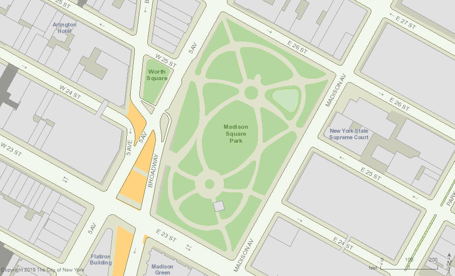
The public burial ground at Post and Bloomingdale roads—the vicinity of present-day 26th Street between Fifth and Madison avenues—was used for just three years. Opposition to transporting the dead on the busy roads leading to the potter’s field compelled the city to discontinue its use in May 1797 and open a new public burial ground at what is now Washington Square Park. The abandoned potter’s field at Post and Bloomingdale roads transferred to the United States government for an arsenal in 1806; later it was the location of the House of Refuge for juvenile delinquents. In 1847, the site was leveled, sodded, and enclosed to create Madison Square Park.
The site’s history as a potters field was recognized even after it was converted into an arsenal, as evidenced in this 1809 notice of a deserted soldier.
Though the burial ground was used only for a short period, hundreds of people likely were interred there during this calamitous time. Some burials were disinterred when the U.S. government built a powder-and-shot magazine at the site; in 1808, L’Oracle (one of the city’s early 19th century newspapers)reported that “persons employed in digging the foundation of the Magazine in the Old Potter’s Field daily dig up coffins and dead bodies which are disposed of in the most indecent and disrespectful manner.” On several occasions in the early 20th century, construction workers uncovered human remains at the north end of the park during excavations for sewer lines and water pipes. Burials may still be present beneath the park.
Excerpt of 1930 New York Times article reporting discovery of remains of the potter’s field in Madison Square Park.Map of Madison Square Park (NYCityMap)
Sources: Randel’s 1820 Farm Maps, No. 14; Minutes of the Common Council of the City of New York, 1784-1831 (City of New York 1917), 2:92, 102, 351, 365; Manual of the Corporation of the City of New York (Valentine 1856), 465; The Iconography of Manhattan Island: 1498-1909 (Stokes 1915-1928), 5:1313, 1474, 1494; Bellevue: Three Centuries of Medicine and Mayhem at America’s Most Storied Hospital (Oshinsky 2016), 11-28; “Twenty Dollars Reward” [Notice], New York Evening Post, Apr 8 1809; “Park Once Potter’s Field, New York Times, July 11, 1908; “Unearth Skeleton in Park,” New York Times, Sep 11, 1930.
A 19th-century depiction of the first Almshouse (1736-1797) now the site of City Hall (NYPL)
In the early 1730s, the growing city of New York—then about 9,000 people clustered at the south end of Manhattan—was grappling with the problem of poverty. The “Number and Continual Increase of the Poor within this City is very great and Exceeding burthensome to the Inhabitants thereof,” the Common Council reported in 1734, necessitating construction of a municipal poorhouse, or almshouse. The Almshouse opened in 1736 on the Commons, a triangular piece of communal pastureland at what was then the northern edge of the city. The Almshouse served as a shelter for the poor who were unable to work due to old age or illness and a workhouse/house of corrections for impoverished people considered able to work but “living Idly and unimployed,” as well as “all disorderly persons, parents of Bastard Children, Beggars, Servants running away or otherwise misbehaving themselves, Trespassers, Rogues, [and] Vagabonds.”
Maerschalck’s 1755 map shows the “Poor House,” or Almshouse, situated in the Commons
Along with housing the sick, impoverished widows, and orphans, the Almshouse put the idle back to work and incarcerated criminals. Inmates (the term used to refer to residents of all public institutions during this time period) received clothing and followed strict daily schedules consisting of meals, prayer, and work (carding wool, making buttons, shredding old rope for reuse, or raising garden crops). In 1785, the Almshouse had 301 inmates—63 men, 133 women, 50 boys, 49 girls, and “2 Black Men & 4 Black Women.” Stays ranged from a day up to the death of an inmate.
Over the course of the 18th century, the Commons became the site of a number of other public buildings including the Gaol, or Jail, completed in 1759, east of the Almshouse; the Bridewell, a prison built in 1775 west of the Almshouse; and the Barracks, four structures constructed at the north end of the Commons beginning in 1757 to house soldiers. Areas surrounding these buildings were used as institutional burial grounds. A fenced burial place for deceased Almshouse inmates was established in 1757 “to the Eastward of and adjoining to the fence of the said Work House, of the Length of two Boards.” Apparently this graveyard was filled by 1785, when the Keeper of the Almshouse requested new grounds for this purpose and the city ordered that vacant ground “in the rear of the Barracks” be used for interment of those dying in the Almshouse and the Bridewell.
The Almshouse and other structures in the Commons, 1776-96 (Bankoff & Loorya 2008)
In 1797, the city built a new almshouse just north of the first almshouse, which was demolished at that time. In 1803, City Hall was erected on the site the first Almshouse, and the Commons began to transform into today’s City Hall Park, located just south of Chambers Street, between Broadway and Centre streets. In 1816, the poor were relocated to a complex at Bellevue and the second Almshouse building was used a cultural center until it was demolished in 1857; it is now the site of Tweed Courthouse. As the Commons changed from an area of social welfare, penal institutions, and military housing to the seat of local government, the Almshouse burial grounds vanished beneath City Hall Park. Long thought to have been obliterated by two centuries of construction activity, the forgotten burial grounds reappeared during archaeological work connected with recent renovation projects.
Map of City Hall Park, including City Hall and Tweed Courthouse (NYCityMap)
More than 50 graves, and disturbed human remains representing at least 200 more individuals, have been found in the north section of City Hall Park since the late 1990s and are believed to be associated with the first Almshouse and the Commons’ other 18th-century institutions. Intact burials were left in place during the excavations, protected to prevent disturbance and covered over again; they rest under the lawns and paved areas near City Hall and Tweed Courthouse. Disturbed burials and fragmentary human remains were collected, analyzed, and eventually reburied in the northeastern corner of the park near Chambers and Centre streets.
Analysis of the skeletal remains suggests people consistent with the Almshouse population—most appear to be of European ancestry; males and females, young and old adults, infants and children are all represented; and many show the traces of lives spent in hard work, poorly healed fractures, and pathologies caused by illness or poor nutrition. These discoveries provide a view of an overlooked segment of society—those unfortunate and unruly early New Yorkers laid to rest in the Almshouse burial grounds, souls no longer forgotten.
Human remains from the Almshouse burial grounds discovered in the northeast corner of City Hall Park, 1999 (Bankoff & Loorya 2008)Commemorative marker in a lawn at the northeast corner of City Hall Park, where human remains from the Almshouse burial grounds were reinterred (Mary French)
Sources:Maerschalck’s 1755 Plan of the City of New York from an Actual Survey; Minutes of the Common Council of the City of New York, 1675-1776 (City of New York 1905), 4:240-241, 308-309; 6:85-86; Minutes of the Common Council of the City of New York, 1784-1831 (City of New York 1917), 1:151, 158, 184-185; Tweed Courthouse Archeological Survey and Data Retrieval Investigations (Hartgen 2003); The History and Archaeology of City Hall Park(Bankoff & Loorya 2008); “Colonial-Era Human Remains Are Unearthed Near City Hall,” New York Times, Oct 25, 1998; “Ghosts From a Long-Ago Poorhouse in City Hall Park,” New York Times, Jun 11, 1999; “Under City Hall Park,” Archaeology Magazine, Feb 25, 2000; “The City Hall Park Project, Archaeology Magazine, Feb 12, 2007; Touring Gotham’s Archaeological Past (Wall & Cantwell 2004), 46-49; “Bones From Historic Downtown Burial Grounds Reinterred in City Hall Park,” DNA Info, Nov 12, 2013; History of Poverty & Homelessness in NYC; Historical Marker Database.