Numerous stones left atop these monuments at United Hebrew Cemetery attest to frequent visits (Mary French)
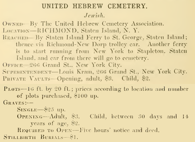
In contrast to many of New York City’s Jewish burial grounds, which often have a deserted air about them, United Hebrew Cemetery on Staten Island hums with activity. On an average day, cars line the cemetery’s roadways, paths are filled with family and friends visiting their departed loved ones, and a yarmulke-wearing manager zips around the grounds on a golf cart. The cemetery’s history begins when the United Hebrew Cemetery Association of New York City incorporated in 1906. The association later acquired 67 acres on Arthur Kill Road in the Richmond section of Staten Island and opened to burials in 1908. United Hebrew now is the resting place of 40,000 Jews from the Bronx, Brooklyn, Staten Island, and the Lower East Side of Manhattan. In its early years, United Hebrew sold plots to about 200 burial societies and benevolent associations. Today its grounds are sold directly to families or individuals, and recent emigration from the former Soviet Union has resulted in an increase in burials over the past few decades.
The Drobniner Holocaust memorial at United Hebrew Cemetery (Steven Lasky/Museum of Family History)
Among those interred at United Hebrew Cemetery are countless people touched by the Holocaust and monuments found throughout the cemetery memorialize those who suffered or died under Nazism.The Holocaust memorials are dedicated to specific towns that lost their Jewish population to the Nazi regime and their collaborators, or to the many Jews themselves who once inhabited these towns. A monument in the Eishishok Society plot at United Hebrew commemorates more than 4,000 Jews of the Lithuanian shtetl of Eishyshok who were massacred by German troops in 1941. Another large monument, erected by the Drobniner Benevolent Society, commemorates 3,000 Jews from the town of Drobnin, Poland, who were gassed and cremated at the Auschwitz concentration camp. Buried at the foot of the Drobniner monument are ashes brought from Auschwitz in 1961 by one of the camp’s survivors, Rabbi David Foffer.
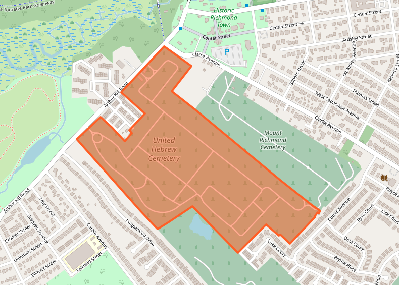
Burial site of ashes from Auschwitz interred at the foot of the Drobniner monument (Steven Lasky/Museum of Family History)Listing for United Hebrew Cemetery in a 1910 directory of NYC cemeteriesLocation of United Hebrew Cemetery on Arthur Kill Road in Staten Island (OpenStreetMap)
Sources: “Incorporations Filed,” Buffalo Courier, Nov 2, 1906; Fairchild Cemetery Manual (1910), 164-165; Annual reports of the Board of Health of the City of New York, 1900-1925; “Rites for Nazi Victims,” New York Times, Nov 27, 1961; “Jewish Cemeteries Recall Era of Immigration, Times of Suffering, Moments of Forgiveness,” Staten Island Advance, Jul 26, 2005; Carved in Granite: Holocaust Memorials in Greater New York Jewish Cemeteries (Poplack 2003); “Holocaust Memorials of New York and New Jersey,” Museum of Family History; OpenStreetMap
Entrance gate to Riker Cemetery, June 2016 (Mary French)
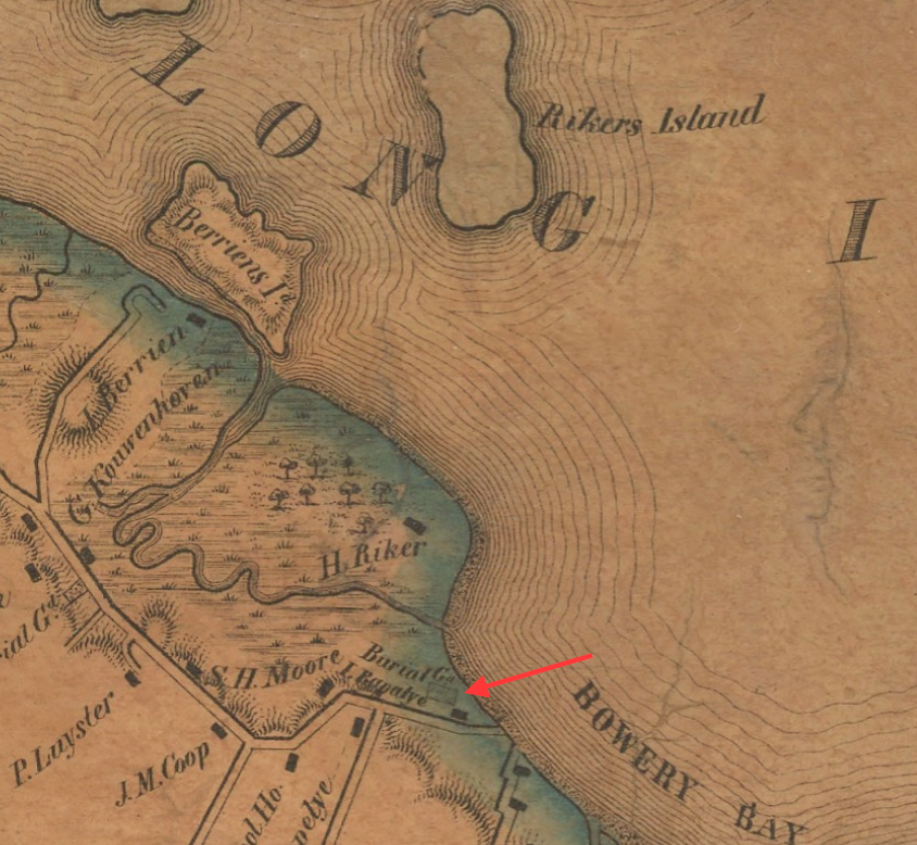
Long before the name “Riker” was synonymous with the violence and despair of one of America’s most notorious penitentiaries, it was a mark of pedigree that brought to mind one of New York’s most prominent families. The story of this Dutch American dynasty begins with Abraham Rycken van Lent, who arrived in New Amsterdam in 1638 and in 1654 received a land grant near the shore of Bowery Bay in northwestern Queens. In 1664 he was granted the neighboring island on which the Rikers Island jail complex now stands. Abraham Rycken’s descendants occupied their mainland estate and offshore island for the next 200 years, most of them eventually adopting the anglicized surname Riker. An 1877 article in the Newtown Register proclaimed the Rikers “one of the most versatile, patriotic, and learned families” the area had produced, a prolific and distinguished folk that included a host of soldiers, lawyers, merchants, and physicians.
This detail from an 1849 map shows the Riker Cemetery situated behind the Abraham Lent house (then owned by Isaac Rapelye) on Bowery Bay Road (today’s 19th Road)
Adjoining Abraham Rycken’s homestead (which now lies under LaGuardia Airport) was that of Harck Siboutsen, who around 1650 settled the land immediately west of Rycken’s property. Rycken’s son Ryck-Abramsen—who used the surname Lent rather than Riker—married Siboutsen’s daughter Catrina. Their son Abraham Lent (1674-1746) inherited the Siboutsen homestead and ca.1729 erected a house there (likely incorporating an earlier structure) that still stands at 78-03 19th Road in East Elmhurst. Behind this house is Riker Cemetery, first recorded in Abraham Lent’s 1742 will. In that will he directed that his farm be sold to the highest bidder among his children, with the provision “except for the Burying place, which is to remain entire as it now lies for the use of the relations and friends, with free egress to the same.”
Tombstones in Riker Cemetery, ca. 1900 (Whittemore)
In 1919 the Queens Topographical Bureau surveyed the 88×78-foot Riker Cemetery, locating 132 gravestones. A number of these were rough-hewn fieldstones and tablets with no markings or inscribed only with initials (a brownstone marked “A.L.” might be that of Abraham Lent). The earliest identifiable graves were those of Johannis Riker (1721-1744) and Abraham Riker (1655-1746), the eighth son of Abraham Rycken and inheritor of the Riker homestead and Rikers Island.
Obituary of Revolutionary War veteran John Berrien Riker, 1794
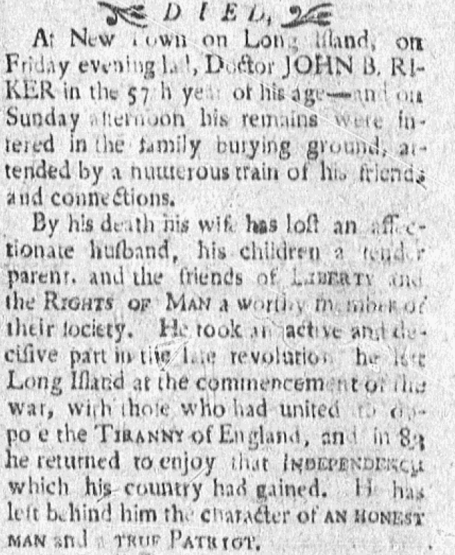
The most illustrious occupant of Riker Cemetery is Dr. John Berrien Riker, a patriot of the American Revolution. Born on the Riker homestead in 1738, he was educated at Princeton University and subsequently practiced medicine in New Jersey. Historians credit Riker with saving the life of future U.S. President James Monroe during the Battle of Trenton on December 26, 1776, when he clamped a severed artery in a near-fatal gunshot wound to Monroe’s shoulder. After Trenton Riker remained with Washington’s army and was commissioned as a surgeon of the 4th Battalion of New Jersey troops in February of 1777. When peace was established in 1783, Riker returned to his native home in Queens where he died in 1794 at age 57.
Also here is the grave of Dr. William James MacNeven (1763-1841), a celebrated Irish physician, scientist, and member of the United Irishmen who was exiled from Ireland after the failed rebellion of 1798. Connected to the family by his 1810 marriage to Jane Margaret Riker, MacNeven’s burial site in Riker Cemetery has long been a place of pilgrimage for local Hibernian societies. MacNeven is likewise memorialized in a 35-foot-tall cenotaph in St. Paul’s Churchyard in Manhattan.
This 1923 view of Riker Cemetery from 19th Avenue shows the wooden fence that surrounded the burial ground before it was replaced by the current brick enclosure ca. 1930 (NYPL)
Riker family members continued to be buried in their ancestral burial ground at Bowery Bay into the 1930s and various occupants of the nearby Abraham Lent house looked after the cemetery throughout the years. For most of the 19th century the house was occupied by members of the Rapelye family, who were affiliated with the Rikers through intermarriage and are said to have guarded the cemetery with “jealous care.” In 1941 a branch of the Riker family re-acquired the property and installed an elderly Swiss caretaker, Rudolph Durheim, to look after the house and burial ground. Durheim was interred in the cemetery upon his death in 1944.
A view of tombstones in Riker Cemetery, June 2016 (Mary French)
Since the 1970s the Abraham Lent home has been owned and occupied by Michael Smith and his wife Marion Duckworth Smith, who restored the home and preserved the Riker Cemetery. When Michael Smith died in 2010, he was interred in Riker Cemetery alongside several of Mrs. Smith’s family members. Today the house is the oldest building in New York City still used as a private residence; the adjacent burial ground is protected by a high brick wall with a wrought-iron gate emblazoned, “RIKER.”
This 2008 aerial image shows the modern surroundings of Riker Cemetery (arrow); the adjacent Abraham Lent house can be seen near 19th Road; the entrance to the Rikers Island Bridge is a half-block west on 19th Avenue (NYCityMap)Rikers Island Bridge entrance, June 2016 (Mary French)
Sources: Sidney’sMap of Twelve Miles around New-York, 1849; The Annals of Newtown (Riker 1852); Long Island Historic Homes, Ancient and Modern (Whittemore 1901); Description of Private and Family Cemeteries in the Borough of Queens (Powell & Meigs 1932); 300 Years of Long Island City (Seyfried 1984); The Rikers: Their Island, Homes, Cemetery and Early Genealogy (Nutt 2004); “Walks through Old Cemeteries—The Riker Family,” Newtown Register, Aug 23, 1877; “Residences Which Are Historical,” Brooklyn Daily Eagle, Oct 22, 1899; “Alonzo D. Riker,” Brooklyn Times Union, Aug 23, 1910; “Shrine of Irish Patriot Found at Old Riker Grave Yard on Bowery Bay Shore,” Brooklyn Daily Eagle, Sep 19, 1920; “J.J. Riker Rites Tomorrow,” Brooklyn Daily Eagle, Aug 5, 1932; “High Walls Protect Old Riker Cemetery,” Long Island Daily Press, Dec 16, 1935; “Pioneers and Irish Patriots Share Resting Place in Old Riker Cemetery,” Long Island Star Journal, Jun 18, 1940; “Died,”Greenleafs New York Journal, Sept 10, 1794; Revolutionary War Pension Applications—John Berrien Riker (Ancestry.com); “Doctor Riker’s Decision,” Hektoen International, Summer 2016; “Re-naming Rikers,” Pacific Standard, Jun 14, 2017
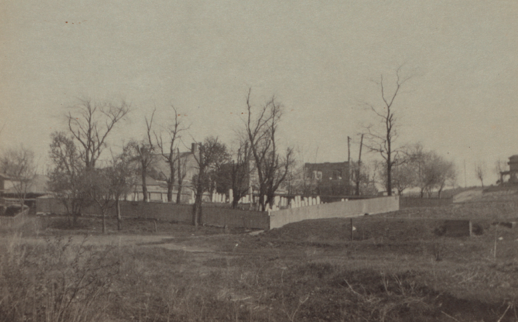
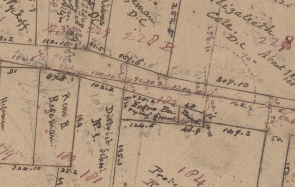
Detail from an 1855 map showing the Negro Burying Ground situated between District School No. 1 and the Town Pound, at what is now the junction of Bedford and Church avenues in Flatbush
In 1810, the Long Island Star published an obituary for “a negro woman named Eve, aged near 110 years,” who died in the village of Flatbush. At the time of her death, Eve was enslaved to Lawrence Voorhes, one of the largest slaveholders in Flatbush as well as in all of Kings County. Slavery was widespread among the Dutch families of Kings County who depended heavily on enslaved black laborers to work their land. At the first U.S. census in 1790, slaves accounted for one-third of the total population of Kings County and two-fifths of Flatbush’s population. Eve might have been among the 13 slaves enumerated in Lawrence Voorhes’ household in the 1800 census, which did not list slaves individually by name.
Obituary of the enslaved woman Eve, who was buried in Flatbush’s African burial ground in 1810
Eve’s obituary notes that “her remains were piously interred in the African burying ground of the village of Flatbush, attended by a great concourse of the people of colour.” An 1855 map of Flatbush depicts the “Negro Burying Ground” at what is now the junction of Bedford and Church avenues. It was just east of the main village that centered around the Flatbush Reformed Dutch Church—still standing one block to the west on Flatbush and Church avenues—and was adjacent to the Town Pound where horses, cattle, and other animals were confined. Little more is known of this burial ground, which may have been established soon after the arrival of slaves in Flatbush in the 17th century and used by Flatbush’s African American community into the mid-19th century.
An 1873 map of Flatbush shows the Reformed Dutch Church property north of Holy Cross Cemetery where remains from the African burial ground might have been relocated.
In his 1884 history of Kings County, Brooklyn historian Henry Stiles writes that the “colored people’s burying-ground” of Flatbush, located on property owned by the Reformed Dutch Church, was removed when Bedford Avenue was laid out in 1865 and the remains reinterred at “a new burying-ground in another section of the Reformed Church land, at the northeast corner of the cemetery of the Holy Cross.” Some have interpreted Stiles’ statement to mean that the remains were reinterred inHoly Cross Cemetery, the Catholic cemetery founded in Flatbush in 1849. However, Holy Cross Cemetery has no record that remains from the African burial ground were interred there and it’s unlikely that they would have been removed to this Catholic burial ground. It’s more likely Stiles’ statement refers to Reformed Dutch Church property that is shown adjacent to the northern boundary of Holy Cross Cemetery on several 19th-century maps, and that the remains might have been reburied somewhere on this land. Whatever the case may be, no evidence of a reburial site can be found today.
1904 newspaper clipping reporting the discovery of a skeleton that may have been associated with Flatbush’s African burial ground
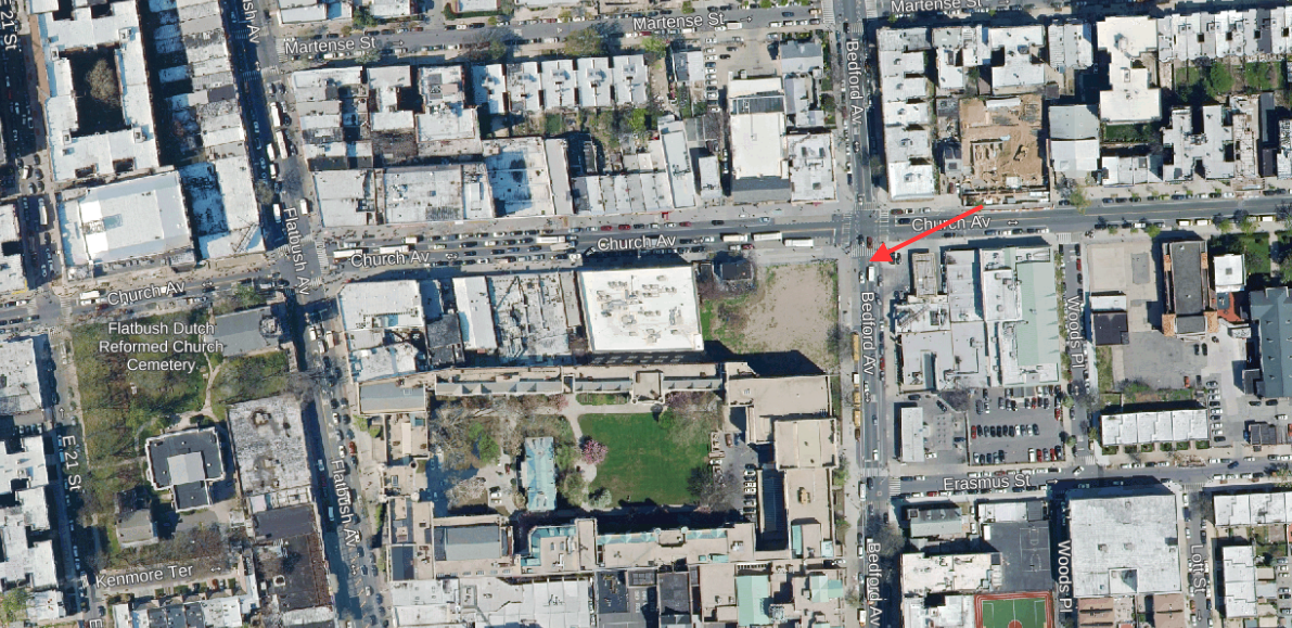
It’s possible that traces of Flatbush’s African burial ground still exist at the junction of Church and Bedford avenues, where human remains have been discovered on several occasions. Workmen unearthed skeletons at the site during sewer construction in 1890 and again in 1904. Local historians have also suggested that the Flatbush District School No.1, erected in 1842 at the southwest corner of Bedford and Church avenues, was built on part of the African burial ground and that graves were disturbed when the school was constructed. This site was later occupied by Public School 90, which the city demolished in 2015 for safety reasons. When the city was considering reusing the then-vacant school building in the early 2000s, archaeologists conducted test excavations to determine if any evidence of a cemetery could be found on the school grounds; although they located no graves, they did recover four human teeth and fragments of a mandible that might have been associated with the African burial ground. The P.S. 90 school site is currently slated for development into an affordable housing and community space; a task force has been established to handle any remains that may be discovered and to consider potential memorialization of the history of the site.
A 2018 aerial view of Bedford and Church avenues in Flatbush; arrow indicates approximate location of the African burial ground; the vacant lot at the southwest corner of Church and Bedford avenues is the former P.S. 90 site slated for redevelopment; the historic Flatbush Reformed Dutch Church can be seen one block west at Flatbush Avenue